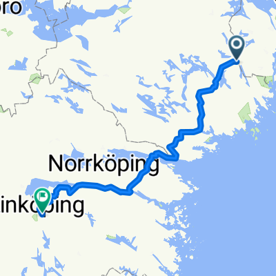
Land of Lakes & Castles (Mälby NO canoeing)
Mälby to Laxne (no bridge)
A cycling route starting in Gnesta, Södermanland County, Sweden.
Overview
About this route
- 1 h 40 min
- Duration
- 28.6 km
- Distance
- 409 m
- Ascent
- 391 m
- Descent
- 17.1 km/h
- Avg. speed
- 63 m
- Max. altitude
Part of
Route quality
Waytypes & surfaces along the route
Waytypes
Road
7.7 km
(27 %)
Quiet road
5.7 km
(20 %)
Surfaces
Paved
23.8 km
(83 %)
Unpaved
4.3 km
(15 %)
Asphalt
23.5 km
(82 %)
Gravel
4.3 km
(15 %)
Route highlights
Points of interest along the route
Point of interest after 0 km
Be careful on this road as cars travel fast!
Point of interest after 3 km
Keep straight here even if your map shows take right
Point of interest after 3.6 km
Supermarket
Point of interest after 3.9 km
Gustafsvik cafe
Point of interest after 9 km
Detour to viewpoint (recommended)
Point of interest after 9.6 km
Viewpoint over Lake Klämmingen (recommended)
Point of interest after 9.7 km
Klämmingbergsbadet beach (toilet)
Point of interest after 11.3 km
Kattnäs church
Point of interest after 15 km
Take left for picturesque route on country lanes (can continue straight and reduce with 3.5 km)
Point of interest after 20.5 km
Vängsö airfield
Point of interest after 24.7 km
Heby manor
Point of interest after 25.1 km
Picturesque rest stop by lake Klämmingen
Point of interest after 27.7 km
Laxne beach and toilet
Point of interest after 28.4 km
Take left towards Skottvångs Gruva
Point of interest after 28.6 km
Meeting point for canoes at 12:00
Continue with Bikemap
Use, edit, or download this cycling route
You would like to ride Mälby to Laxne (no bridge) or customize it for your own trip? Here is what you can do with this Bikemap route:
Free features
- Save this route as favorite or in collections
- Copy & plan your own version of this route
- Sync your route with Garmin or Wahoo
Premium features
Free trial for 3 days, or one-time payment. More about Bikemap Premium.
- Navigate this route on iOS & Android
- Export a GPX / KML file of this route
- Create your custom printout (try it for free)
- Download this route for offline navigation
Discover more Premium features.
Get Bikemap PremiumFrom our community
Other popular routes starting in Gnesta
 iki Almviko
- Distance
- 20.2 km
- Ascent
- 193 m
- Descent
- 178 m
- Location
- Gnesta, Södermanland County, Sweden
 Gnesta Kalleskrona
- Distance
- 522.8 km
- Ascent
- 336 m
- Descent
- 373 m
- Location
- Gnesta, Södermanland County, Sweden
 Sillen Runt
- Distance
- 30.3 km
- Ascent
- 257 m
- Descent
- 258 m
- Location
- Gnesta, Södermanland County, Sweden
 Södertuna to Laxne (working)
- Distance
- 18.8 km
- Ascent
- 189 m
- Descent
- 175 m
- Location
- Gnesta, Södermanland County, Sweden
 bikepack2
- Distance
- 47.7 km
- Ascent
- 252 m
- Descent
- 265 m
- Location
- Gnesta, Södermanland County, Sweden
 Förslag 2 Gnestaalternativet
- Distance
- 168.3 km
- Ascent
- 371 m
- Descent
- 370 m
- Location
- Gnesta, Södermanland County, Sweden
 Hem-Gnesta-Göta kanal
- Distance
- 184.5 km
- Ascent
- 1,471 m
- Descent
- 1,428 m
- Location
- Gnesta, Södermanland County, Sweden
 Mälby-Laxne (canoeing)
- Distance
- 27 km
- Ascent
- 209 m
- Descent
- 204 m
- Location
- Gnesta, Södermanland County, Sweden
Open it in the app

