

Zwischen Wald und Reben - RTF des RV Falke Donnersberg Göllheim e.V. - 151 km Strecke
A cycling route starting in Göllheim, Rhineland-Palatinate, Germany.
Overview
About this route
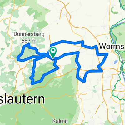
Zwischen Wald und Reben - 151 km
geführte RTF (G) des RV Falke Donnersberg Göllheim e.V.
Alle weiteren Hinweise zu dieser Strecke -> hier anklicken
- -:--
- Duration
- 155.1 km
- Distance
- 1,327 m
- Ascent
- 1,355 m
- Descent
- ---
- Avg. speed
- 345 m
- Max. altitude

Route quality
Waytypes & surfaces along the route
Waytypes
Road
31 km
(20 %)
Quiet road
9.3 km
(6 %)
Surfaces
Paved
133.4 km
(86 %)
Unpaved
1.6 km
(1 %)
Asphalt
131.9 km
(85 %)
Paved (undefined)
1.6 km
(1 %)
Route highlights
Points of interest along the route
Point of interest after 26.2 km
Kontrolle 1 und 4
Drinking water after 52.2 km
Kontrolle 2 Mölsheim
Drinking water after 89.2 km
Kontrolle 3 Freinsheim
Continue with Bikemap
Use, edit, or download this cycling route
You would like to ride Zwischen Wald und Reben - RTF des RV Falke Donnersberg Göllheim e.V. - 151 km Strecke or customize it for your own trip? Here is what you can do with this Bikemap route:
Free features
- Save this route as favorite or in collections
- Copy & plan your own version of this route
- Split it into stages to create a multi-day tour
- Sync your route with Garmin or Wahoo
Premium features
Free trial for 3 days, or one-time payment. More about Bikemap Premium.
- Navigate this route on iOS & Android
- Export a GPX / KML file of this route
- Create your custom printout (try it for free)
- Download this route for offline navigation
Discover more Premium features.
Get Bikemap PremiumFrom our community
Other popular routes starting in Göllheim
 Wo ist die Sch... Brücke?
- Distance
- 81.3 km
- Ascent
- 112 m
- Descent
- 270 m
- Location
- Göllheim, Rhineland-Palatinate, Germany
 Zwischen Wald und Reben - RTF des RV Falke Donnersberg Göllheim e.V. - 41 km Strecke
- Distance
- 40.8 km
- Ascent
- 421 m
- Descent
- 450 m
- Location
- Göllheim, Rhineland-Palatinate, Germany
 Heinrich-Heine-Straße, Göllheim nach Am Gielbrunnen, Eisenberg
- Distance
- 8.5 km
- Ascent
- 85 m
- Descent
- 162 m
- Location
- Göllheim, Rhineland-Palatinate, Germany
 RTF100.Donnersbergrunde
- Distance
- 154.3 km
- Ascent
- 1,032 m
- Descent
- 1,037 m
- Location
- Göllheim, Rhineland-Palatinate, Germany
 Tour de Romantica 2011 - RTF des RV Falke Donnersberg Göllheim e.V. - 82 km Strecke
- Distance
- 81.5 km
- Ascent
- 553 m
- Descent
- 571 m
- Location
- Göllheim, Rhineland-Palatinate, Germany
 Göllheimer Winter-CTF (große Runde 47 km)
- Distance
- 47.1 km
- Ascent
- 808 m
- Descent
- 808 m
- Location
- Göllheim, Rhineland-Palatinate, Germany
 Stumpfwaldgericht-Eiswoog-Ebertsheim Runde
- Distance
- 45 km
- Ascent
- 433 m
- Descent
- 433 m
- Location
- Göllheim, Rhineland-Palatinate, Germany
 Tour de Romantica 2011 - RTF des RV Falke Donnersberg Göllheim e.V. - 115 km Strecke
- Distance
- 115.5 km
- Ascent
- 803 m
- Descent
- 737 m
- Location
- Göllheim, Rhineland-Palatinate, Germany
Open it in the app