

mittenmang, reinickendorf-schöneberg
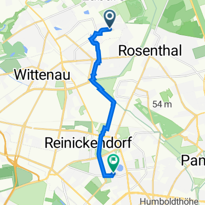
A cycling route starting in Märkisches Viertel, State of Berlin, Germany.
Overview
About this route
recommended only on Sundays, too much traffic during the week
- -:--
- Duration
- 18.1 km
- Distance
- 29 m
- Ascent
- 37 m
- Descent
- ---
- Avg. speed
- 48 m
- Max. altitude

Route quality
Waytypes & surfaces along the route
Waytypes
Cycleway
4.2 km
(23 %)
Quiet road
3.6 km
(20 %)
Surfaces
Paved
13.4 km
(74 %)
Unpaved
0.2 km
(1 %)
Asphalt
13.4 km
(74 %)
Gravel
0.2 km
(1 %)
Undefined
4.5 km
(25 %)
Continue with Bikemap
Use, edit, or download this cycling route
You would like to ride mittenmang, reinickendorf-schöneberg or customize it for your own trip? Here is what you can do with this Bikemap route:
Free features
- Save this route as favorite or in collections
- Copy & plan your own version of this route
- Sync your route with Garmin or Wahoo
Premium features
Free trial for 3 days, or one-time payment. More about Bikemap Premium.
- Navigate this route on iOS & Android
- Export a GPX / KML file of this route
- Create your custom printout (try it for free)
- Download this route for offline navigation
Discover more Premium features.
Get Bikemap PremiumFrom our community
Other popular routes starting in Märkisches Viertel
 Senftenberger Ring 8, Berlin nach Senftenberger Ring 10, Berlin
- Distance
- 2.2 km
- Ascent
- 0 m
- Descent
- 0 m
- Location
- Märkisches Viertel, State of Berlin, Germany
 Rund um Lübars
- Distance
- 12.6 km
- Ascent
- 90 m
- Descent
- 87 m
- Location
- Märkisches Viertel, State of Berlin, Germany
 Eichhorster Weg 46–48, Berlin nach Eichhorster Straße 24, Friedland
- Distance
- 146.9 km
- Ascent
- 732 m
- Descent
- 711 m
- Location
- Märkisches Viertel, State of Berlin, Germany
 Senftenberger Ring 10, Berlin nach Senftenberger Ring 10, Berlin
- Distance
- 5 km
- Ascent
- 26 m
- Descent
- 27 m
- Location
- Märkisches Viertel, State of Berlin, Germany
 Finsterwalder Straße 16, Berlin nach Markscheiderstraße 30–32, Berlin
- Distance
- 3.1 km
- Ascent
- 14 m
- Descent
- 16 m
- Location
- Märkisches Viertel, State of Berlin, Germany
 Senftenberger Ring 48, Berlin nach Vierwaldstätter Weg 7, Berlin
- Distance
- 6.5 km
- Ascent
- 20 m
- Descent
- 22 m
- Location
- Märkisches Viertel, State of Berlin, Germany
 Mauerradweg-Flughafen Tempelhof
- Distance
- 50 km
- Ascent
- 80 m
- Descent
- 79 m
- Location
- Märkisches Viertel, State of Berlin, Germany
 mittenmang, reinickendorf-schöneberg
- Distance
- 18.1 km
- Ascent
- 29 m
- Descent
- 37 m
- Location
- Märkisches Viertel, State of Berlin, Germany
Open it in the app