Poppeltal-Schwarzenberg
A cycling route starting in Enzklösterle, Baden-Wurttemberg, Germany.
Overview
About this route
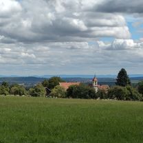
At the end of the route (or at the turnaround point) in Schwarzenberg lies the Panoramahütte, inviting you to a snack.
- -:--
- Duration
- 5.9 km
- Distance
- 212 m
- Ascent
- 343 m
- Descent
- ---
- Avg. speed
- ---
- Max. altitude
Route quality
Waytypes & surfaces along the route
Waytypes
Track
5.9 km
(100 %)
Surfaces
Paved
0.2 km
(3 %)
Unpaved
5.7 km
(97 %)
Gravel
3.7 km
(62 %)
Loose gravel
1.5 km
(26 %)
Continue with Bikemap
Use, edit, or download this cycling route
You would like to ride Poppeltal-Schwarzenberg or customize it for your own trip? Here is what you can do with this Bikemap route:
Free features
- Save this route as favorite or in collections
- Copy & plan your own version of this route
- Sync your route with Garmin or Wahoo
Premium features
Free trial for 3 days, or one-time payment. More about Bikemap Premium.
- Navigate this route on iOS & Android
- Export a GPX / KML file of this route
- Create your custom printout (try it for free)
- Download this route for offline navigation
Discover more Premium features.
Get Bikemap PremiumFrom our community
Other popular routes starting in Enzklösterle
- Enz-Eyach-Rohnbach
- Distance
- 53.6 km
- Ascent
- 685 m
- Descent
- 685 m
- Location
- Enzklösterle, Baden-Wurttemberg, Germany
- Vom Ursprung der Enz bis zum Enzkreis
- Distance
- 52.1 km
- Ascent
- 184 m
- Descent
- 650 m
- Location
- Enzklösterle, Baden-Wurttemberg, Germany
- Poppeltal-Schwarzenberg
- Distance
- 5.9 km
- Ascent
- 212 m
- Descent
- 343 m
- Location
- Enzklösterle, Baden-Wurttemberg, Germany
- Enz-Murg-Panorama
- Distance
- 45 km
- Ascent
- 737 m
- Descent
- 742 m
- Location
- Enzklösterle, Baden-Wurttemberg, Germany
- Enz und Eyach CLONED FROM ROUTE 245
- Distance
- 49.7 km
- Ascent
- 776 m
- Descent
- 776 m
- Location
- Enzklösterle, Baden-Wurttemberg, Germany
- Enz und Eyach
- Distance
- 49.7 km
- Ascent
- 776 m
- Descent
- 776 m
- Location
- Enzklösterle, Baden-Wurttemberg, Germany
- Enztal-Radweg: Quelle - Pforzheim
- Distance
- 46.3 km
- Ascent
- 176 m
- Descent
- 634 m
- Location
- Enzklösterle, Baden-Wurttemberg, Germany
- Urwalderlebnistour Enzklösterle
- Distance
- 11.5 km
- Ascent
- 246 m
- Descent
- 246 m
- Location
- Enzklösterle, Baden-Wurttemberg, Germany
Open it in the app