
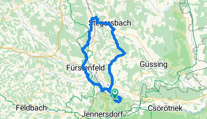
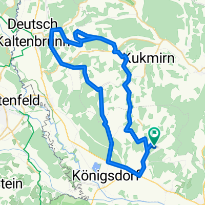
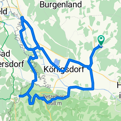
Krobotek,FF,Burgau,stegersbach,kukmirn,Königsdorf,Krobotek
A cycling route starting in Eltendorf, Burgenland, Austria.
Overview
About this route
- -:--
- Duration
- 70.5 km
- Distance
- 420 m
- Ascent
- 419 m
- Descent
- ---
- Avg. speed
- ---
- Max. altitude

Route quality
Waytypes & surfaces along the route
Waytypes
Busy road
31.9 km
(45 %)
Road
18.9 km
(27 %)
Surfaces
Paved
59.7 km
(85 %)
Asphalt
59.7 km
(85 %)
Concrete
0 km
(<1 %)
Undefined
10.8 km
(15 %)
Continue with Bikemap
Use, edit, or download this cycling route
You would like to ride Krobotek,FF,Burgau,stegersbach,kukmirn,Königsdorf,Krobotek or customize it for your own trip? Here is what you can do with this Bikemap route:
Free features
- Save this route as favorite or in collections
- Copy & plan your own version of this route
- Sync your route with Garmin or Wahoo
Premium features
Free trial for 3 days, or one-time payment. More about Bikemap Premium.
- Navigate this route on iOS & Android
- Export a GPX / KML file of this route
- Create your custom printout (try it for free)
- Download this route for offline navigation
Discover more Premium features.
Get Bikemap PremiumFrom our community
Other popular routes starting in Eltendorf
 Über Loipersdorf nach Stein und Eltendorf
- Distance
- 34.4 km
- Ascent
- 219 m
- Descent
- 219 m
- Location
- Eltendorf, Burgenland, Austria
 Südburgenländisches Uhudlerhügelfahren, Bademöglichkeit bei Lafnitz
- Distance
- 19.6 km
- Ascent
- 141 m
- Descent
- 140 m
- Location
- Eltendorf, Burgenland, Austria
 Waldrunde
- Distance
- 10.7 km
- Ascent
- 115 m
- Descent
- 115 m
- Location
- Eltendorf, Burgenland, Austria
 Ausschnitte des B72 Radfahrweges - über den Haarberg zur Lafnitz
- Distance
- 18.1 km
- Ascent
- 150 m
- Descent
- 150 m
- Location
- Eltendorf, Burgenland, Austria
 Große Bergrunde
- Distance
- 14.3 km
- Ascent
- 202 m
- Descent
- 202 m
- Location
- Eltendorf, Burgenland, Austria
 Riesenhügelrunde
- Distance
- 37.5 km
- Ascent
- 356 m
- Descent
- 356 m
- Location
- Eltendorf, Burgenland, Austria
 Thermenrunde
- Distance
- 37.1 km
- Ascent
- 217 m
- Descent
- 217 m
- Location
- Eltendorf, Burgenland, Austria
 Auf nach Mariabild!
- Distance
- 28.1 km
- Ascent
- 251 m
- Descent
- 251 m
- Location
- Eltendorf, Burgenland, Austria
Open it in the app