

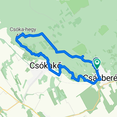
Vértes zöld jelzésen
A cycling route starting in Bodajk, Fejér, Hungary.
Overview
About this route
The green-marked trail proved to be tough terrain with deep ditches and muddy sections. A route with many climbs, but at the end the blue marking finally turns into a nice downhill through the Castle Valley. Pity it ends quickly. The loop is only 14 km, but with very tiring climbs.
- -:--
- Duration
- 13.5 km
- Distance
- 348 m
- Ascent
- 348 m
- Descent
- ---
- Avg. speed
- ---
- Max. altitude
Continue with Bikemap
Use, edit, or download this cycling route
You would like to ride Vértes zöld jelzésen or customize it for your own trip? Here is what you can do with this Bikemap route:
Free features
- Save this route as favorite or in collections
- Copy & plan your own version of this route
- Sync your route with Garmin or Wahoo
Premium features
Free trial for 3 days, or one-time payment. More about Bikemap Premium.
- Navigate this route on iOS & Android
- Export a GPX / KML file of this route
- Create your custom printout (try it for free)
- Download this route for offline navigation
Discover more Premium features.
Get Bikemap PremiumFrom our community
Other popular routes starting in Bodajk
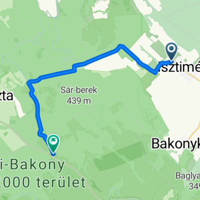 Útvonal innen: Isztimér
- Distance
- 12.4 km
- Ascent
- 225 m
- Descent
- 89 m
- Location
- Bodajk, Fejér, Hungary
 Csókakő - Komárno
- Distance
- 54.8 km
- Ascent
- 178 m
- Descent
- 320 m
- Location
- Bodajk, Fejér, Hungary
 Zrínyi utca 1, Csókakő to Zrínyi utca 1, Csókakő
- Distance
- 13.2 km
- Ascent
- 261 m
- Descent
- 234 m
- Location
- Bodajk, Fejér, Hungary
 Vértes zöld jelzésen
- Distance
- 13.5 km
- Ascent
- 348 m
- Descent
- 348 m
- Location
- Bodajk, Fejér, Hungary
 2016-06-05 BFE túra 2. nap
- Distance
- 38.4 km
- Ascent
- 229 m
- Descent
- 185 m
- Location
- Bodajk, Fejér, Hungary
 Nagyvelegi kör
- Distance
- 20 km
- Ascent
- 287 m
- Descent
- 287 m
- Location
- Bodajk, Fejér, Hungary
 Petőfi Sándor utca - Petőfi Sándor utca
- Distance
- 17.9 km
- Ascent
- 711 m
- Descent
- 711 m
- Location
- Bodajk, Fejér, Hungary
 Bicajtúra 2018 (2. nap)
- Distance
- 78.4 km
- Ascent
- 580 m
- Descent
- 549 m
- Location
- Bodajk, Fejér, Hungary
Open it in the app