

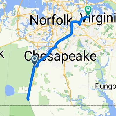
Dismal Swamp, Chesapeake, VA 31 Mile
A cycling route starting in Portsmouth Heights, Virginia, United States.
Overview
About this route
- -:--
- Duration
- 49.9 km
- Distance
- 84 m
- Ascent
- 82 m
- Descent
- ---
- Avg. speed
- ---
- Max. altitude

Route quality
Waytypes & surfaces along the route
Waytypes
Cycleway
17.5 km
(35 %)
Road
14.5 km
(29 %)
Surfaces
Paved
31.9 km
(64 %)
Paved (undefined)
17.5 km
(35 %)
Asphalt
14.5 km
(29 %)
Undefined
18 km
(36 %)
Continue with Bikemap
Use, edit, or download this cycling route
You would like to ride Dismal Swamp, Chesapeake, VA 31 Mile or customize it for your own trip? Here is what you can do with this Bikemap route:
Free features
- Save this route as favorite or in collections
- Copy & plan your own version of this route
- Sync your route with Garmin or Wahoo
Premium features
Free trial for 3 days, or one-time payment. More about Bikemap Premium.
- Navigate this route on iOS & Android
- Export a GPX / KML file of this route
- Create your custom printout (try it for free)
- Download this route for offline navigation
Discover more Premium features.
Get Bikemap PremiumFrom our community
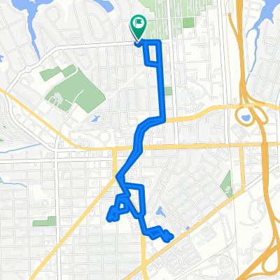
Other popular routes starting in Portsmouth Heights
 Dismal Swamp Canal Trail, Chesapeake to Saint Albans Street 4301, Virginia Beach
- Distance
- 61.4 km
- Ascent
- 85 m
- Descent
- 80 m
- Location
- Portsmouth Heights, Virginia, United States
 Tour de Chesapeake
- Distance
- 80.4 km
- Ascent
- 59 m
- Descent
- 58 m
- Location
- Portsmouth Heights, Virginia, United States
 Dismal Swamp Trail
- Distance
- 26.8 km
- Ascent
- 53 m
- Descent
- 54 m
- Location
- Portsmouth Heights, Virginia, United States
 701 Hamilton Ave, Portsmouth to 647 Hamilton Ave, Portsmouth
- Distance
- 7.9 km
- Ascent
- 0 m
- Descent
- 3 m
- Location
- Portsmouth Heights, Virginia, United States
 Route for breakfast
- Distance
- 10.9 km
- Ascent
- 10 m
- Descent
- 8 m
- Location
- Portsmouth Heights, Virginia, United States
 Dismal Swamp, Chesapeake, VA 31 Mile
- Distance
- 49.9 km
- Ascent
- 84 m
- Descent
- 82 m
- Location
- Portsmouth Heights, Virginia, United States
 Dismal Swamp Canal Trail, Chesapeake to Dismal Swamp Canal Trail, Chesapeake
- Distance
- 16.9 km
- Ascent
- 3 m
- Descent
- 14 m
- Location
- Portsmouth Heights, Virginia, United States
 1246 Dismal Swamp Canal Trail, Chesapeake to 4138–4398 Dismal Swamp Canal Trail, Chesapeake
- Distance
- 13.4 km
- Ascent
- 29 m
- Descent
- 33 m
- Location
- Portsmouth Heights, Virginia, United States
Open it in the app