

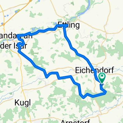
Rundweg Mariakirchen ~ Gergweis ~ Johanniskirchen
A cycling route starting in Eichendorf, Bavaria, Germany.
Overview
About this route
- 2 h 49 min
- Duration
- 50.1 km
- Distance
- 495 m
- Ascent
- 535 m
- Descent
- 17.8 km/h
- Avg. speed
- 451 m
- Max. altitude
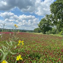
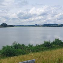
Route photos


Route quality
Waytypes & surfaces along the route
Waytypes
Quiet road
27.3 km
(55 %)
Road
15.9 km
(32 %)
Surfaces
Paved
33.4 km
(67 %)
Unpaved
1.1 km
(2 %)
Asphalt
33.4 km
(67 %)
Gravel
1.1 km
(2 %)
Undefined
15.6 km
(31 %)
Continue with Bikemap
Use, edit, or download this cycling route
You would like to ride Rundweg Mariakirchen ~ Gergweis ~ Johanniskirchen or customize it for your own trip? Here is what you can do with this Bikemap route:
Free features
- Save this route as favorite or in collections
- Copy & plan your own version of this route
- Sync your route with Garmin or Wahoo
Premium features
Free trial for 3 days, or one-time payment. More about Bikemap Premium.
- Navigate this route on iOS & Android
- Export a GPX / KML file of this route
- Create your custom printout (try it for free)
- Download this route for offline navigation
Discover more Premium features.
Get Bikemap PremiumFrom our community
Other popular routes starting in Eichendorf
 Rundweg Mariakirchen ~ Gergweis ~ Johanniskirchen
- Distance
- 50.1 km
- Ascent
- 495 m
- Descent
- 535 m
- Location
- Eichendorf, Bavaria, Germany
 Thalhausen 4, Arnstorf nach Thalhausen 4, Arnstorf
- Distance
- 19.6 km
- Ascent
- 171 m
- Descent
- 174 m
- Location
- Eichendorf, Bavaria, Germany
 Rieger
- Distance
- 75.3 km
- Ascent
- 665 m
- Descent
- 636 m
- Location
- Eichendorf, Bavaria, Germany
 Eichendorf - Vilstalsee Rundtour
- Distance
- 60.5 km
- Ascent
- 393 m
- Descent
- 406 m
- Location
- Eichendorf, Bavaria, Germany
 Perbing-Landau-ettling-perbing
- Distance
- 43.2 km
- Ascent
- 426 m
- Descent
- 423 m
- Location
- Eichendorf, Bavaria, Germany
 Sardinien 2015
- Distance
- 693.4 km
- Ascent
- 105 m
- Descent
- 126 m
- Location
- Eichendorf, Bavaria, Germany
 SZ-4a_Lappersdorf_Ergolding_64,9km 330hm
- Distance
- 64.8 km
- Ascent
- 518 m
- Descent
- 489 m
- Location
- Eichendorf, Bavaria, Germany
 perbing-kamerau-landau-ettling-perbing
- Distance
- 44.9 km
- Ascent
- 486 m
- Descent
- 489 m
- Location
- Eichendorf, Bavaria, Germany
Open it in the app