

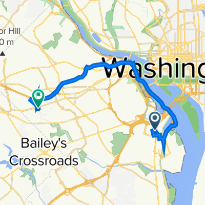
Capital Crescent - Georgetown Branch - Rock Crek Loop
A cycling route starting in Washington D.C., District of Columbia, United States.
Overview
About this route
This is a perfect 20-mile loop vith very little traffic and not that much elevation change.
There is about a mile or two of loose gravel at the northern end (Georgetown Branch), but the rest is paved trail or relatively quiet roadways.
Not recommended during rush hour, though, since Beach Drive in Rock Creek Park can get busy. There are trail alternatives, but the surface quality is not great (potholes, etc).
- -:--
- Duration
- 32.5 km
- Distance
- 172 m
- Ascent
- 174 m
- Descent
- ---
- Avg. speed
- ---
- Max. altitude
Continue with Bikemap
Use, edit, or download this cycling route
You would like to ride Capital Crescent - Georgetown Branch - Rock Crek Loop or customize it for your own trip? Here is what you can do with this Bikemap route:
Free features
- Save this route as favorite or in collections
- Copy & plan your own version of this route
- Sync your route with Garmin or Wahoo
Premium features
Free trial for 3 days, or one-time payment. More about Bikemap Premium.
- Navigate this route on iOS & Android
- Export a GPX / KML file of this route
- Create your custom printout (try it for free)
- Download this route for offline navigation
Discover more Premium features.
Get Bikemap PremiumFrom our community
Other popular routes starting in Washington D.C.
 2023 Coast-to-Coast (East-West) FINAL: 03Jun-28Jul2023
- Distance
- 6,108 km
- Ascent
- 25,430 m
- Descent
- 25,472 m
- Location
- Washington D.C., District of Columbia, United States
 Haines’s point
- Distance
- 17.4 km
- Ascent
- 70 m
- Descent
- 70 m
- Location
- Washington D.C., District of Columbia, United States
 Relaxed route in Arlington
- Distance
- 7.9 km
- Ascent
- 0 m
- Descent
- 3 m
- Location
- Washington D.C., District of Columbia, United States
 1211 S Eads St, Arlington to 601 N Manchester St, Arlington
- Distance
- 18.7 km
- Ascent
- 4 m
- Descent
- 14 m
- Location
- Washington D.C., District of Columbia, United States
 Capital Crescent Loop
- Distance
- 24 km
- Ascent
- 153 m
- Descent
- 154 m
- Location
- Washington D.C., District of Columbia, United States
 ANACOSTIA RIVER TRIAL RIDE
- Distance
- 28.5 km
- Ascent
- 53 m
- Descent
- 53 m
- Location
- Washington D.C., District of Columbia, United States
 1925 Constitution Ave NW, Washington to Constitution Ave NW, Washington
- Distance
- 15.8 km
- Ascent
- 3 m
- Descent
- 9 m
- Location
- Washington D.C., District of Columbia, United States
 Rock Park 14 - 1
- Distance
- 21.6 km
- Ascent
- 214 m
- Descent
- 218 m
- Location
- Washington D.C., District of Columbia, United States
Open it in the app