

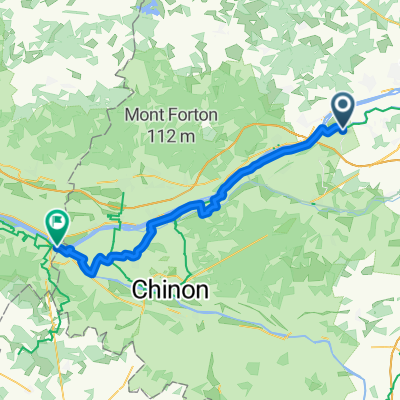
Route to Saumur
A cycling route starting in Villandry, Centre-Val de Loire, France.
Overview
About this route
- 3 h 50 min
- Duration
- 61 km
- Distance
- 282 m
- Ascent
- 302 m
- Descent
- 15.9 km/h
- Avg. speed
- 78 m
- Max. altitude

Route quality
Waytypes & surfaces along the route
Waytypes
Road
24.4 km
(40 %)
Quiet road
20.1 km
(33 %)
Surfaces
Paved
25 km
(41 %)
Unpaved
9.8 km
(16 %)
Asphalt
25 km
(41 %)
Gravel
9.8 km
(16 %)
Undefined
26.2 km
(43 %)
Continue with Bikemap
Use, edit, or download this cycling route
You would like to ride Route to Saumur or customize it for your own trip? Here is what you can do with this Bikemap route:
Free features
- Save this route as favorite or in collections
- Copy & plan your own version of this route
- Sync your route with Garmin or Wahoo
Premium features
Free trial for 3 days, or one-time payment. More about Bikemap Premium.
- Navigate this route on iOS & Android
- Export a GPX / KML file of this route
- Create your custom printout (try it for free)
- Download this route for offline navigation
Discover more Premium features.
Get Bikemap PremiumFrom our community
Other popular routes starting in Villandry
 Villandry (haut des lys) - Montsoreau (bussy)
- Distance
- 49.7 km
- Ascent
- 45 m
- Descent
- 45 m
- Location
- Villandry, Centre-Val de Loire, France
 9km moulinet
- Distance
- 8.1 km
- Ascent
- 308 m
- Descent
- 304 m
- Location
- Villandry, Centre-Val de Loire, France
 Route to Saumur
- Distance
- 61 km
- Ascent
- 282 m
- Descent
- 302 m
- Location
- Villandry, Centre-Val de Loire, France
 Trip 10
- Distance
- 12.7 km
- Ascent
- 79 m
- Descent
- 85 m
- Location
- Villandry, Centre-Val de Loire, France
 boucle villandry
- Distance
- 19.6 km
- Ascent
- 31 m
- Descent
- 29 m
- Location
- Villandry, Centre-Val de Loire, France
 Villandry_Azay_Usse_Langeais
- Distance
- 62.4 km
- Ascent
- 236 m
- Descent
- 236 m
- Location
- Villandry, Centre-Val de Loire, France
 RUTERO DE LA SEGUNDA ETAPA
- Distance
- 164.7 km
- Ascent
- 154 m
- Descent
- 151 m
- Location
- Villandry, Centre-Val de Loire, France
 Villandry (colombien) - Chinon (agnes sorel)
- Distance
- 48.5 km
- Ascent
- 209 m
- Descent
- 222 m
- Location
- Villandry, Centre-Val de Loire, France
Open it in the app