
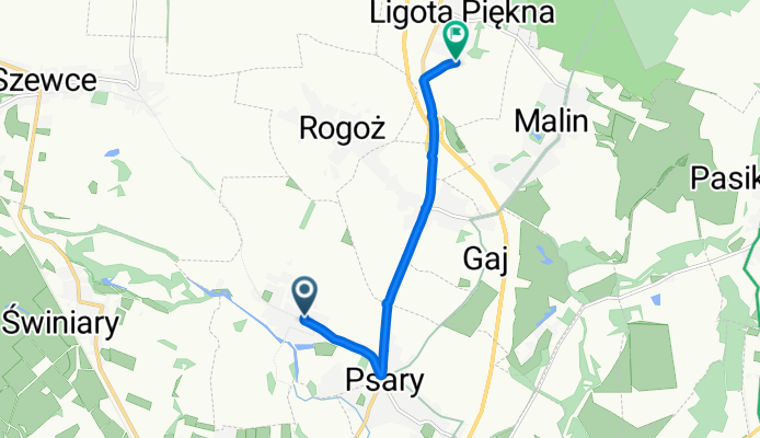
Lotnicza 78, Szymanów do Polna 1D, Ligota Piękna
A cycling route starting in Psary, Lower Silesian Voivodeship, Poland.
Overview
About this route
- 22 min
- Duration
- 5.8 km
- Distance
- 25 m
- Ascent
- 3 m
- Descent
- 15.5 km/h
- Avg. speed
- 140 m
- Max. altitude

Route quality
Waytypes & surfaces along the route
Waytypes
Path
3.4 km
(58 %)
Quiet road
1.5 km
(26 %)
Surfaces
Paved
3.2 km
(55 %)
Unpaved
0.6 km
(10 %)
Asphalt
3.2 km
(55 %)
Gravel
0.6 km
(10 %)
Undefined
2 km
(35 %)
Continue with Bikemap
Use, edit, or download this cycling route
You would like to ride Lotnicza 78, Szymanów do Polna 1D, Ligota Piękna or customize it for your own trip? Here is what you can do with this Bikemap route:
Free features
- Save this route as favorite or in collections
- Copy & plan your own version of this route
- Sync your route with Garmin or Wahoo
Premium features
Free trial for 3 days, or one-time payment. More about Bikemap Premium.
- Navigate this route on iOS & Android
- Export a GPX / KML file of this route
- Create your custom printout (try it for free)
- Download this route for offline navigation
Discover more Premium features.
Get Bikemap PremiumFrom our community
Other popular routes starting in Psary
 Zamki i Pałace I
- Distance
- 40.8 km
- Ascent
- 102 m
- Descent
- 91 m
- Location
- Psary, Lower Silesian Voivodeship, Poland
 Las Osobowicki - Las Redzinski - Las Osobowicki
- Distance
- 20.8 km
- Ascent
- 79 m
- Descent
- 80 m
- Location
- Psary, Lower Silesian Voivodeship, Poland
 trzebnica001
- Distance
- 46.8 km
- Ascent
- 269 m
- Descent
- 271 m
- Location
- Psary, Lower Silesian Voivodeship, Poland
 W PELETONIE Z R.SZURKOWSKIM I S. SZOZDĄ
- Distance
- 10.9 km
- Ascent
- 31 m
- Descent
- 28 m
- Location
- Psary, Lower Silesian Voivodeship, Poland
 Po mieście
- Distance
- 22.5 km
- Ascent
- 14 m
- Descent
- 12 m
- Location
- Psary, Lower Silesian Voivodeship, Poland
 Bajkał
- Distance
- 19.7 km
- Ascent
- 14 m
- Descent
- 10 m
- Location
- Psary, Lower Silesian Voivodeship, Poland
 Gravel Attack
- Distance
- 151.7 km
- Ascent
- 1,030 m
- Descent
- 1,021 m
- Location
- Psary, Lower Silesian Voivodeship, Poland
 LGD-R-zielony_zachodni
- Distance
- 21.4 km
- Ascent
- 99 m
- Descent
- 47 m
- Location
- Psary, Lower Silesian Voivodeship, Poland
Open it in the app