

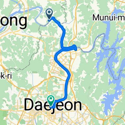
대청호 한바퀴
A cycling route starting in Sintansin, Daejeon, South Korea.
Overview
About this route
- 5 h 31 min
- Duration
- 82 km
- Distance
- 1,265 m
- Ascent
- 1,335 m
- Descent
- 14.8 km/h
- Avg. speed
- 305 m
- Max. altitude

Continue with Bikemap
Use, edit, or download this cycling route
You would like to ride 대청호 한바퀴 or customize it for your own trip? Here is what you can do with this Bikemap route:
Free features
- Save this route as favorite or in collections
- Copy & plan your own version of this route
- Split it into stages to create a multi-day tour
- Sync your route with Garmin or Wahoo
Premium features
Free trial for 3 days, or one-time payment. More about Bikemap Premium.
- Navigate this route on iOS & Android
- Export a GPX / KML file of this route
- Create your custom printout (try it for free)
- Download this route for offline navigation
Discover more Premium features.
Get Bikemap PremiumFrom our community
Other popular routes starting in Sintansin
 Chudong_Hangoongni
- Distance
- 64.7 km
- Ascent
- 901 m
- Descent
- 898 m
- Location
- Sintansin, Daejeon, South Korea
 Daecheongho
- Distance
- 79.3 km
- Ascent
- 821 m
- Descent
- 834 m
- Location
- Sintansin, Daejeon, South Korea
 금호리, 세종특별자치시에서 둔산대로, 대전광역시까지
- Distance
- 27 km
- Ascent
- 121 m
- Descent
- 112 m
- Location
- Sintansin, Daejeon, South Korea
![Ph0]에서 경로신탄진동 145-3](https://media.bikemap.net/routes/12685289/staticmaps/in_e3d21b2d-999a-4829-96d8-847c8894a885_400x400_bikemap-2021-3D-static.png) Ph0]에서 경로신탄진동 145-3
Ph0]에서 경로신탄진동 145-3- Distance
- 15.1 km
- Ascent
- 31 m
- Descent
- 62 m
- Location
- Sintansin, Daejeon, South Korea
 대청호 한바퀴
- Distance
- 82 km
- Ascent
- 1,265 m
- Descent
- 1,335 m
- Location
- Sintansin, Daejeon, South Korea
 미호동 1−5 to 성산면, 군산시
- Distance
- 144.8 km
- Ascent
- 127 m
- Descent
- 207 m
- Location
- Sintansin, Daejeon, South Korea
 금강 종주자전거길
- Distance
- 91.9 km
- Ascent
- 191 m
- Descent
- 267 m
- Location
- Sintansin, Daejeon, South Korea
 안골 - 와동싱글 - 어은동
- Distance
- 24.8 km
- Ascent
- 315 m
- Descent
- 294 m
- Location
- Sintansin, Daejeon, South Korea
Open it in the app