

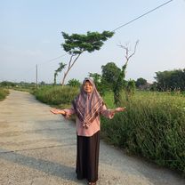
Sore_Ceria
A cycling route starting in Kendal, Central Java, Indonesia.
Overview
About this route
- 1 h 42 min
- Duration
- 8.9 km
- Distance
- 100 m
- Ascent
- 159 m
- Descent
- 5.2 km/h
- Avg. speed
- 68 m
- Max. altitude

Route quality
Waytypes & surfaces along the route
Waytypes
Quiet road
7.6 km
(85 %)
Road
1 km
(11 %)
Continue with Bikemap
Use, edit, or download this cycling route
You would like to ride Sore_Ceria or customize it for your own trip? Here is what you can do with this Bikemap route:
Free features
- Save this route as favorite or in collections
- Copy & plan your own version of this route
- Sync your route with Garmin or Wahoo
Premium features
Free trial for 3 days, or one-time payment. More about Bikemap Premium.
- Navigate this route on iOS & Android
- Export a GPX / KML file of this route
- Create your custom printout (try it for free)
- Download this route for offline navigation
Discover more Premium features.
Get Bikemap PremiumFrom our community
Other popular routes starting in Kendal
 minggu pagi
- Distance
- 19.9 km
- Ascent
- 99 m
- Descent
- 115 m
- Location
- Kendal, Central Java, Indonesia
 kendal Sumuk
- Distance
- 4 km
- Ascent
- 56 m
- Descent
- 44 m
- Location
- Kendal, Central Java, Indonesia
 Relaxed route in Kecamatan Kendal
- Distance
- 45.1 km
- Ascent
- 569 m
- Descent
- 568 m
- Location
- Kendal, Central Java, Indonesia
 Jalan Lanji to Jalan Lanji
- Distance
- 25.2 km
- Ascent
- 40 m
- Descent
- 41 m
- Location
- Kendal, Central Java, Indonesia
 Route to stadion
- Distance
- 1.5 km
- Ascent
- 3 m
- Descent
- 0 m
- Location
- Kendal, Central Java, Indonesia
 Route to Jalan Raya Soekarno-Hatta 223, Kecamatan Kendal
- Distance
- 11.2 km
- Ascent
- 115 m
- Descent
- 119 m
- Location
- Kendal, Central Java, Indonesia
 stadion
- Distance
- 10.6 km
- Ascent
- 13 m
- Descent
- 46 m
- Location
- Kendal, Central Java, Indonesia
 goes to masjid kapal
- Distance
- 8.5 km
- Ascent
- 337 m
- Descent
- 295 m
- Location
- Kendal, Central Java, Indonesia
Open it in the app