
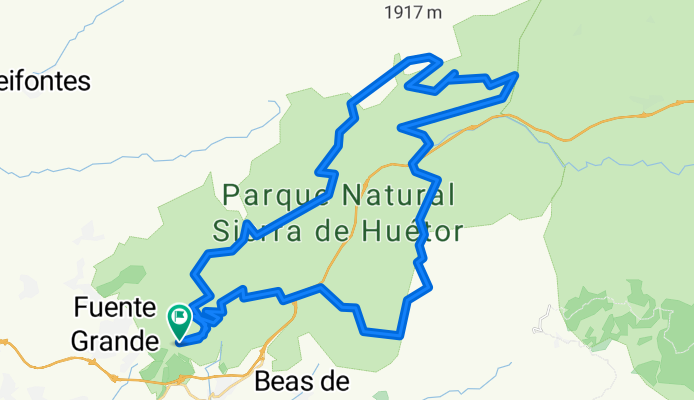
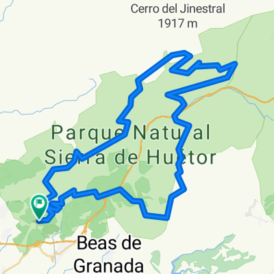
Circular Sierra de Huetor Pistas
A cycling route starting in Víznar, Andalusia, Spain.
Overview
About this route
Be careful to start at Puerto Lobo as we ended up in a ravine full of brambles. Nice route, mainly on tracks, 68 km, about 1600 m of elevation gain. 6 hours.
- -:--
- Duration
- 60.7 km
- Distance
- 1,104 m
- Ascent
- 1,104 m
- Descent
- ---
- Avg. speed
- ---
- Max. altitude

Continue with Bikemap
Use, edit, or download this cycling route
You would like to ride Circular Sierra de Huetor Pistas or customize it for your own trip? Here is what you can do with this Bikemap route:
Free features
- Save this route as favorite or in collections
- Copy & plan your own version of this route
- Sync your route with Garmin or Wahoo
Premium features
Free trial for 3 days, or one-time payment. More about Bikemap Premium.
- Navigate this route on iOS & Android
- Export a GPX / KML file of this route
- Create your custom printout (try it for free)
- Download this route for offline navigation
Discover more Premium features.
Get Bikemap PremiumFrom our community
Other popular routes starting in Víznar
 2011.04.17_Fague-Huétor Santillán-Cañada del Sereno-Alfaguara-Fargue
- Distance
- 35.2 km
- Ascent
- 898 m
- Descent
- 896 m
- Location
- Víznar, Andalusia, Spain
 Viznar 2009
- Distance
- 49.3 km
- Ascent
- 792 m
- Descent
- 784 m
- Location
- Víznar, Andalusia, Spain
 Circular Sierra de Huetor Pistas
- Distance
- 60.6 km
- Ascent
- 1,104 m
- Descent
- 1,104 m
- Location
- Víznar, Andalusia, Spain
 Circular Sierra de Huetor Pistas
- Distance
- 60.7 km
- Ascent
- 1,133 m
- Descent
- 1,125 m
- Location
- Víznar, Andalusia, Spain
 Circular Sierra de Huetor Pistas
- Distance
- 60.7 km
- Ascent
- 1,104 m
- Descent
- 1,104 m
- Location
- Víznar, Andalusia, Spain
 Cañada del Sereno 21/06/08 GRBK+RodarXcampO - GR168
- Distance
- 33.3 km
- Ascent
- 1,090 m
- Descent
- 890 m
- Location
- Víznar, Andalusia, Spain
 Puerto del Lobo
- Distance
- 27.3 km
- Ascent
- 621 m
- Descent
- 610 m
- Location
- Víznar, Andalusia, Spain
 5-8-10 Trincheras en la Sierra de Huétor (IBP: 68)
- Distance
- 28.8 km
- Ascent
- 717 m
- Descent
- 717 m
- Location
- Víznar, Andalusia, Spain
Open it in the app