

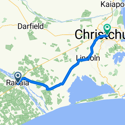
Rakaia to Geraldine - back roads
A cycling route starting in Rakaia, Canterbury, New Zealand.
Overview
About this route
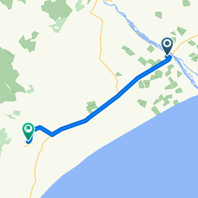
Again, tried to stay clear of highways. But no option sometimes. However, little traffic anywhere apart from SH1. MTB territory as much is gravel. But good ride! Watch out for electric fence on Old South Rd in one spot - farmer has fenced it off!
A great ride into the southerly wind!
- -:--
- Duration
- 94.6 km
- Distance
- 153 m
- Ascent
- 146 m
- Descent
- ---
- Avg. speed
- ---
- Max. altitude
Continue with Bikemap
Use, edit, or download this cycling route
You would like to ride Rakaia to Geraldine - back roads or customize it for your own trip? Here is what you can do with this Bikemap route:
Free features
- Save this route as favorite or in collections
- Copy & plan your own version of this route
- Split it into stages to create a multi-day tour
- Sync your route with Garmin or Wahoo
Premium features
Free trial for 3 days, or one-time payment. More about Bikemap Premium.
- Navigate this route on iOS & Android
- Export a GPX / KML file of this route
- Create your custom printout (try it for free)
- Download this route for offline navigation
Discover more Premium features.
Get Bikemap PremiumFrom our community
Other popular routes starting in Rakaia
 Neuseeland Südinsel 28. Etappe
- Distance
- 66.7 km
- Ascent
- 26 m
- Descent
- 119 m
- Location
- Rakaia, Canterbury, New Zealand
 Rakaia to Geraldine
- Distance
- 81 km
- Ascent
- 106 m
- Descent
- 94 m
- Location
- Rakaia, Canterbury, New Zealand
 2. Tag
- Distance
- 88.3 km
- Ascent
- 177 m
- Descent
- 170 m
- Location
- Rakaia, Canterbury, New Zealand
 2.tag
2.tag- Distance
- 88.2 km
- Ascent
- 181 m
- Descent
- 171 m
- Location
- Rakaia, Canterbury, New Zealand
 Rakaia to Geraldine - back roads
- Distance
- 94.6 km
- Ascent
- 153 m
- Descent
- 146 m
- Location
- Rakaia, Canterbury, New Zealand
 NZ 2009_12_18
- Distance
- 89.2 km
- Ascent
- 181 m
- Descent
- 179 m
- Location
- Rakaia, Canterbury, New Zealand
Open it in the app