

Tour d'Enfer : Day 1 - Morzine to La Clusaz
A cycling route starting in Morzine, Auvergne-Rhône-Alpes, France.
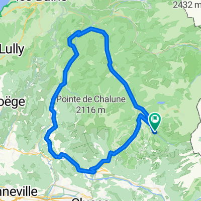
Overview
About this route
- -:--
- Duration
- 75.7 km
- Distance
- 1,814 m
- Ascent
- 1,629 m
- Descent
- ---
- Avg. speed
- 1,688 m
- Max. altitude

Route quality
Waytypes & surfaces along the route
Waytypes
Busy road
37 km
(49 %)
Road
25.5 km
(34 %)
Surfaces
Paved
63.2 km
(83 %)
Unpaved
1 km
(1 %)
Asphalt
62.1 km
(82 %)
Paved (undefined)
1.1 km
(1 %)
Continue with Bikemap
Use, edit, or download this cycling route
You would like to ride Tour d'Enfer : Day 1 - Morzine to La Clusaz or customize it for your own trip? Here is what you can do with this Bikemap route:
Free features
- Save this route as favorite or in collections
- Copy & plan your own version of this route
- Sync your route with Garmin or Wahoo
Premium features
Free trial for 3 days, or one-time payment. More about Bikemap Premium.
- Navigate this route on iOS & Android
- Export a GPX / KML file of this route
- Create your custom printout (try it for free)
- Download this route for offline navigation
Discover more Premium features.
Get Bikemap PremiumFrom our community
Other popular routes starting in Morzine
 Avoriaz and above to Col du Fornet
- Distance
- 47.9 km
- Ascent
- 1,535 m
- Descent
- 1,530 m
- Location
- Morzine, Auvergne-Rhône-Alpes, France
 Day 1
Day 1- Distance
- 137.6 km
- Ascent
- 3,476 m
- Descent
- 3,461 m
- Location
- Morzine, Auvergne-Rhône-Alpes, France
 Morzine - Col de la Joux Verte
- Distance
- 30.3 km
- Ascent
- 861 m
- Descent
- 861 m
- Location
- Morzine, Auvergne-Rhône-Alpes, France
 Tour du Roc d'Enfer
- Distance
- 78.9 km
- Ascent
- 1,128 m
- Descent
- 1,121 m
- Location
- Morzine, Auvergne-Rhône-Alpes, France
 Morzine - Col de la Ramaz - Col de la Colombière
- Distance
- 133.7 km
- Ascent
- 2,660 m
- Descent
- 2,654 m
- Location
- Morzine, Auvergne-Rhône-Alpes, France
 gets rondje
- Distance
- 44.5 km
- Ascent
- 1,626 m
- Descent
- 1,574 m
- Location
- Morzine, Auvergne-Rhône-Alpes, France
 Tour d'Enfer : Day 1 - Morzine to La Clusaz
- Distance
- 75.7 km
- Ascent
- 1,814 m
- Descent
- 1,629 m
- Location
- Morzine, Auvergne-Rhône-Alpes, France
 Joux Verte-Joux Plane-Ramaz-Encrenaz
- Distance
- 106.8 km
- Ascent
- 3,605 m
- Descent
- 3,602 m
- Location
- Morzine, Auvergne-Rhône-Alpes, France
Open it in the app