

Circuit VTT n°2 Plaine Tonique à Étrez
A cycling route starting in Montrevel-en-Bresse, Auvergne-Rhône-Alpes, France.
Overview
About this route
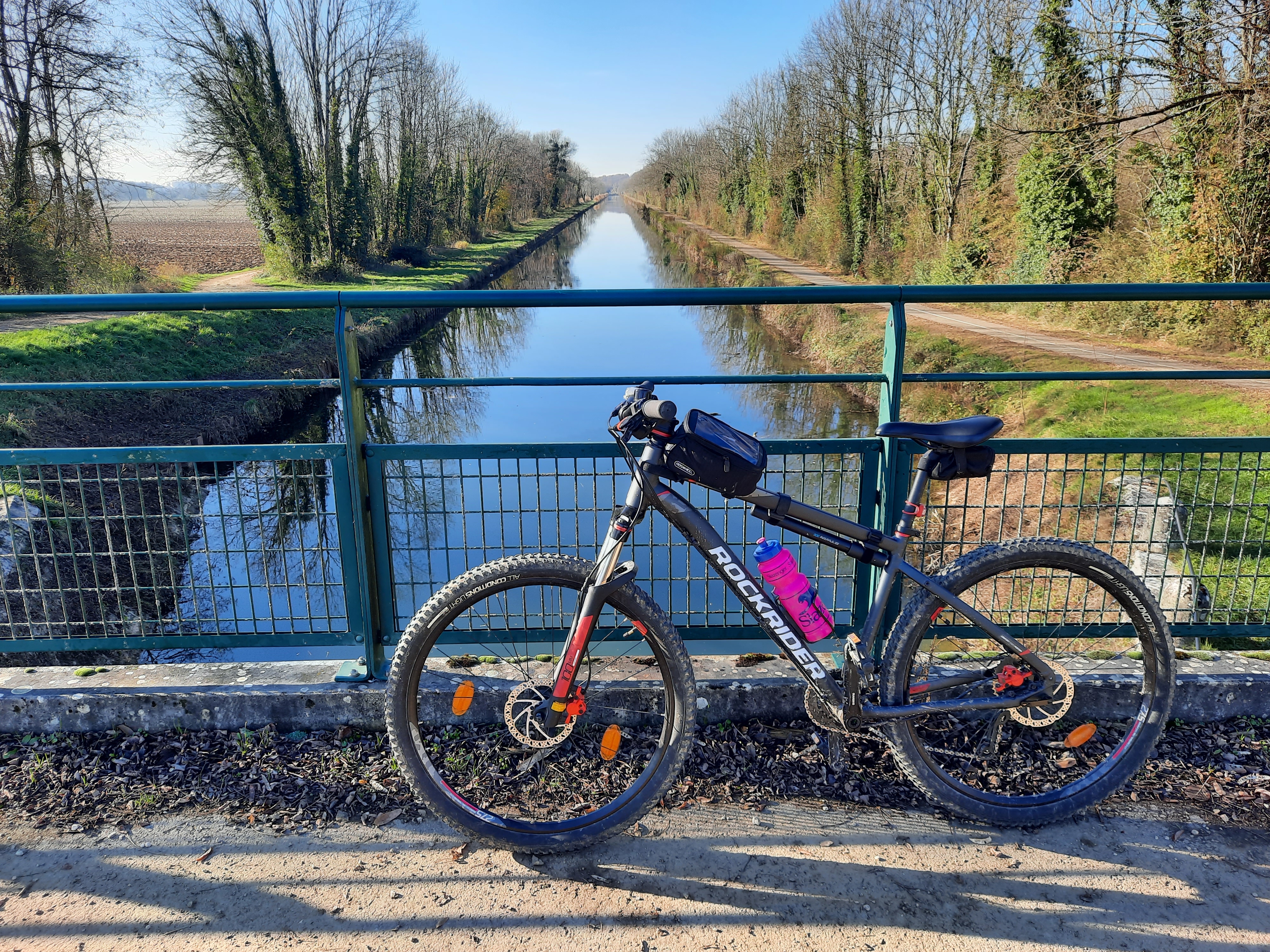
Two atmospheres, the large lake and the banks of the Reyssouze River to start before taking the paths of Bresse for a loop around the village of Etrez. In the heart of the Bressane plain, a tour of the lakes, departing from the leisure base at La Plaine Tonique or from the small village of Etrez. A simple little ride on wide paths, well almost, as the Reyssouze River has carved a valley at the foot of the village. So, a good pedal stroke is needed to climb these meadows of the Bressan bocage before a nice descent back... but it goes smoothly, like butter :] In reference to the AOP-AOC 'Beurre et Crème de Bresse' and the cheese dairies of Etrez and Foissiat.
- -:--
- Duration
- 16 km
- Distance
- 57 m
- Ascent
- 57 m
- Descent
- ---
- Avg. speed
- 225 m
- Max. altitude
Route quality
Waytypes & surfaces along the route
Waytypes
Track
8.6 km
(54 %)
Quiet road
4.6 km
(29 %)
Surfaces
Paved
0.6 km
(4 %)
Unpaved
2.2 km
(14 %)
Ground
2.1 km
(13 %)
Paved (undefined)
0.6 km
(4 %)
Continue with Bikemap
Use, edit, or download this cycling route
You would like to ride Circuit VTT n°2 Plaine Tonique à Étrez or customize it for your own trip? Here is what you can do with this Bikemap route:
Free features
- Save this route as favorite or in collections
- Copy & plan your own version of this route
- Sync your route with Garmin or Wahoo
Premium features
Free trial for 3 days, or one-time payment. More about Bikemap Premium.
- Navigate this route on iOS & Android
- Export a GPX / KML file of this route
- Create your custom printout (try it for free)
- Download this route for offline navigation
Discover more Premium features.
Get Bikemap PremiumFrom our community
Other popular routes starting in Montrevel-en-Bresse
 montrevel - jassans 70 km
- Distance
- 70.4 km
- Ascent
- 170 m
- Descent
- 169 m
- Location
- Montrevel-en-Bresse, Auvergne-Rhône-Alpes, France
 Circuit VTT n°2 Plaine Tonique à Étrez
- Distance
- 16 km
- Ascent
- 57 m
- Descent
- 57 m
- Location
- Montrevel-en-Bresse, Auvergne-Rhône-Alpes, France
 Circuit VTT n°5 lacs à l'étang Pontremble
- Distance
- 44.6 km
- Ascent
- 244 m
- Descent
- 245 m
- Location
- Montrevel-en-Bresse, Auvergne-Rhône-Alpes, France
 De Rue de l'Église, Montrevel-en-Bresse à 8–9 Place de l'Hôtel de Ville, Bourg-en-Bresse
- Distance
- 19.1 km
- Ascent
- 56 m
- Descent
- 38 m
- Location
- Montrevel-en-Bresse, Auvergne-Rhône-Alpes, France
 Village Tonique, Malafretaz naar Village Tonique, Malafretaz
- Distance
- 21.9 km
- Ascent
- 165 m
- Descent
- 165 m
- Location
- Montrevel-en-Bresse, Auvergne-Rhône-Alpes, France
 Circuit VTT n°3 lacs et forêts
- Distance
- 20.6 km
- Ascent
- 101 m
- Descent
- 101 m
- Location
- Montrevel-en-Bresse, Auvergne-Rhône-Alpes, France
 iti 2
iti 2- Distance
- 913 km
- Ascent
- 918 m
- Descent
- 1,046 m
- Location
- Montrevel-en-Bresse, Auvergne-Rhône-Alpes, France
 ronde saint sulpice
- Distance
- 36.4 km
- Ascent
- 304 m
- Descent
- 305 m
- Location
- Montrevel-en-Bresse, Auvergne-Rhône-Alpes, France
Open it in the app