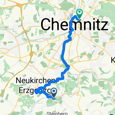
Rundweg Chemnitz Süd - Pfarrhübel, Wasserschloss
A cycling route starting in Neukirchen, Saxony, Germany.
Overview
About this route
- 1 h 52 min
- Duration
- 28.5 km
- Distance
- 382 m
- Ascent
- 379 m
- Descent
- 15.3 km/h
- Avg. speed
- 474 m
- Avg. speed
Route photos
Route quality
Waytypes & surfaces along the route
Waytypes
Track
10.8 km
(38 %)
Quiet road
7.6 km
(27 %)
Surfaces
Paved
18.7 km
(65 %)
Unpaved
6.7 km
(23 %)
Asphalt
15.8 km
(55 %)
Gravel
4.1 km
(14 %)
Continue with Bikemap
Use, edit, or download this cycling route
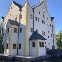
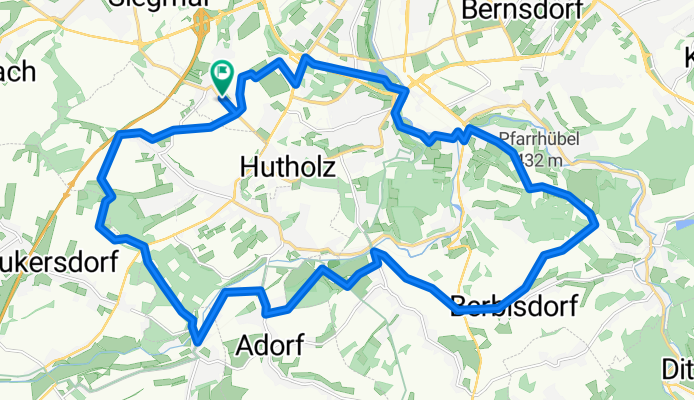
You would like to ride Rundweg Chemnitz Süd - Pfarrhübel, Wasserschloss or customize it for your own trip? Here is what you can do with this Bikemap route:
Free features
- Save this route as favorite or in collections
- Copy & plan your own version of this route
- Sync your route with Garmin or Wahoo
Premium features
Free trial for 3 days, or one-time payment. More about Bikemap Premium.
- Navigate this route on iOS & Android
- Export a GPX / KML file of this route
- Create your custom printout (try it for free)
- Download this route for offline navigation
Discover more Premium features.
Get Bikemap PremiumFrom our community
Other popular routes starting in Neukirchen
- Lichtenstein über Ursprung
- Distance
- 43 km
- Ascent
- 331 m
- Descent
- 329 m
- Location
- Neukirchen, Saxony, Germany
- ADFC Feierabend
- Distance
- 27.5 km
- Ascent
- 286 m
- Descent
- 270 m
- Location
- Neukirchen, Saxony, Germany
- Vom Chemnitzer Westen über Küchwald /Glößa zurück durch den Stadtpark
- Distance
- 55.2 km
- Ascent
- 375 m
- Descent
- 377 m
- Location
- Neukirchen, Saxony, Germany
- RR Tour Meerane
- Distance
- 99.6 km
- Ascent
- 423 m
- Descent
- 388 m
- Location
- Neukirchen, Saxony, Germany
- 500 Hm Trainingsrunde
- Distance
- 36.6 km
- Ascent
- 595 m
- Descent
- 595 m
- Location
- Neukirchen, Saxony, Germany
- Chemnitz - Südböhmen - Südmähren
- Distance
- 844.3 km
- Ascent
- 2,001 m
- Descent
- 2,130 m
- Location
- Neukirchen, Saxony, Germany
- Zwönitz
- Distance
- 52.3 km
- Ascent
- 727 m
- Descent
- 723 m
- Location
- Neukirchen, Saxony, Germany
- Oberwald Hohenstein querdurch
- Distance
- 42.8 km
- Ascent
- 430 m
- Descent
- 433 m
- Location
- Neukirchen, Saxony, Germany
Open it in the app