Mission - Circle to Durieu 2
A cycling route starting in Abbotsford, British Columbia, Canada.
Overview
About this route
This was our best ride so far since pedaling into Canada a week or so ago. We were on some excellent forest and country roads with minimal traffic and nice scenery. Just a mile or two of the ride was on Highway 7, which has good road shoulder on this section. Using Dewdney Trunk Road from Highway 7 (with a minor detour on a more bike friendly road) was much better than our previous "best ride through Durieu", on which we used Highway 7 all the way to Nelson Street. Overall, excellent ride.
Note for a longer ride. From looking at the map, I see that we could have continued farther north on Slave Lake Road and then cut over to Sylvester Road on Hartley Road. That would have added some additional mileage and presumably more nice scenery and riding.
- 2 h 44 min
- Duration
- 40.4 km
- Distance
- 664 m
- Ascent
- 667 m
- Descent
- 14.8 km/h
- Avg. speed
- 179 m
- Max. altitude
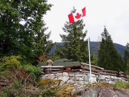
Route photos
Route quality
Waytypes & surfaces along the route
Waytypes
Road
17 km
(42 %)
Quiet road
8.5 km
(21 %)
Surfaces
Paved
11.3 km
(28 %)
Asphalt
11.3 km
(28 %)
Undefined
29.1 km
(72 %)
Continue with Bikemap
Use, edit, or download this cycling route
You would like to ride Mission - Circle to Durieu 2 or customize it for your own trip? Here is what you can do with this Bikemap route:
Free features
- Save this route as favorite or in collections
- Copy & plan your own version of this route
- Sync your route with Garmin or Wahoo
Premium features
Free trial for 3 days, or one-time payment. More about Bikemap Premium.
- Navigate this route on iOS & Android
- Export a GPX / KML file of this route
- Create your custom printout (try it for free)
- Download this route for offline navigation
Discover more Premium features.
Get Bikemap PremiumFrom our community
Other popular routes starting in Abbotsford
 North Abbotsford Loop
- Distance
- 23.8 km
- Ascent
- 168 m
- Descent
- 172 m
- Location
- Abbotsford, British Columbia, Canada
 Mission - Circle to Hayward Lake
- Distance
- 36.3 km
- Ascent
- 758 m
- Descent
- 755 m
- Location
- Abbotsford, British Columbia, Canada
 First 50k
- Distance
- 50.7 km
- Ascent
- 350 m
- Descent
- 353 m
- Location
- Abbotsford, British Columbia, Canada
 Mission Stave Falls
- Distance
- 46.3 km
- Ascent
- 575 m
- Descent
- 570 m
- Location
- Abbotsford, British Columbia, Canada
 Relaxed route in Abbotsford
- Distance
- 24.5 km
- Ascent
- 86 m
- Descent
- 85 m
- Location
- Abbotsford, British Columbia, Canada
 Picton Street 3582, Abbotsford to Picton Street 3582, Abbotsford
- Distance
- 60.2 km
- Ascent
- 174 m
- Descent
- 150 m
- Location
- Abbotsford, British Columbia, Canada
 Mission - Circle to Durieu 2
- Distance
- 40.4 km
- Ascent
- 664 m
- Descent
- 667 m
- Location
- Abbotsford, British Columbia, Canada
 Mission to Chilliwack
- Distance
- 51.2 km
- Ascent
- 237 m
- Descent
- 317 m
- Location
- Abbotsford, British Columbia, Canada
Open it in the app


