Gh4-sargasan
A cycling route starting in Adalaj, Gujarat, India.
Overview
About this route
- 1 h 20 min
- Duration
- 17.1 km
- Distance
- 67 m
- Ascent
- 67 m
- Descent
- 12.8 km/h
- Avg. speed
- 86 m
- Avg. speed
Route photos
Continue with Bikemap
Use, edit, or download this cycling route
You would like to ride Gh4-sargasan or customize it for your own trip? Here is what you can do with this Bikemap route:
Free features
- Save this route as favorite or in collections
- Copy & plan your own version of this route
- Sync your route with Garmin or Wahoo
Premium features
Free trial for 3 days, or one-time payment. More about Bikemap Premium.
- Navigate this route on iOS & Android
- Export a GPX / KML file of this route
- Create your custom printout (try it for free)
- Download this route for offline navigation
Discover more Premium features.
Get Bikemap PremiumFrom our community
Other popular routes starting in Adalaj
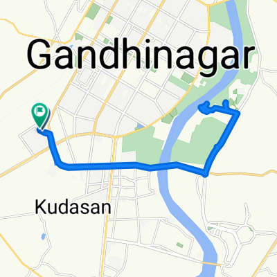
- Punit Van Special Root
- Distance
- 17 km
- Ascent
- 47 m
- Descent
- 52 m
- Location
- Adalaj, Gujarat, India
- Sargasan, Gandhinagar to Megha Malhar Road, Gandhinagar
- Distance
- 18.4 km
- Ascent
- 59 m
- Descent
- 59 m
- Location
- Adalaj, Gujarat, India
- Sargasan, Gandhinagar to Sargasan, Gandhinagar
- Distance
- 14.8 km
- Ascent
- 16 m
- Descent
- 17 m
- Location
- Adalaj, Gujarat, India
- 23.199, 72.611 to 23.198, 72.636
- Distance
- 3.9 km
- Ascent
- 25 m
- Descent
- 23 m
- Location
- Adalaj, Gujarat, India
- Gandhi Mandir
- Distance
- 17.7 km
- Ascent
- 28 m
- Descent
- 29 m
- Location
- Adalaj, Gujarat, India
- Uvarasad Sargasan Road, Gandhinagar to Sargasan, Gandhinagar
- Distance
- 13.4 km
- Ascent
- 26 m
- Descent
- 26 m
- Location
- Adalaj, Gujarat, India
- Sargasan, Gandhinagar to Sargasan, Gandhinagar
- Distance
- 15.1 km
- Ascent
- 36 m
- Descent
- 36 m
- Location
- Adalaj, Gujarat, India
- 23.202, 72.613 to 23.220, 72.649
- Distance
- 6.4 km
- Ascent
- 6 m
- Descent
- 0 m
- Location
- Adalaj, Gujarat, India
Open it in the app