![명륜2가 125-2Ph0]으로 라우팅](/_next/static/media/contour-lines-light-small.cafd5e5d.avif)
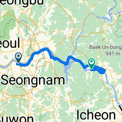
![명륜2가 125-2Ph0]으로 라우팅](https://media.bikemap.net/routes/14650551/staticmaps/in_92a8f217-4def-40b8-99cf-6ce191cc2f83_694x400_bikemap-2021-3D-static.png)
명륜2가 125-2Ph0]으로 라우팅
A cycling route starting in Seoul, Seoul, South Korea.
Overview
About this route
- 37 h 17 min
- Duration
- 70.9 km
- Distance
- 1,522 m
- Ascent
- 1,581 m
- Descent
- 1.9 km/h
- Avg. speed
- 293 m
- Max. altitude

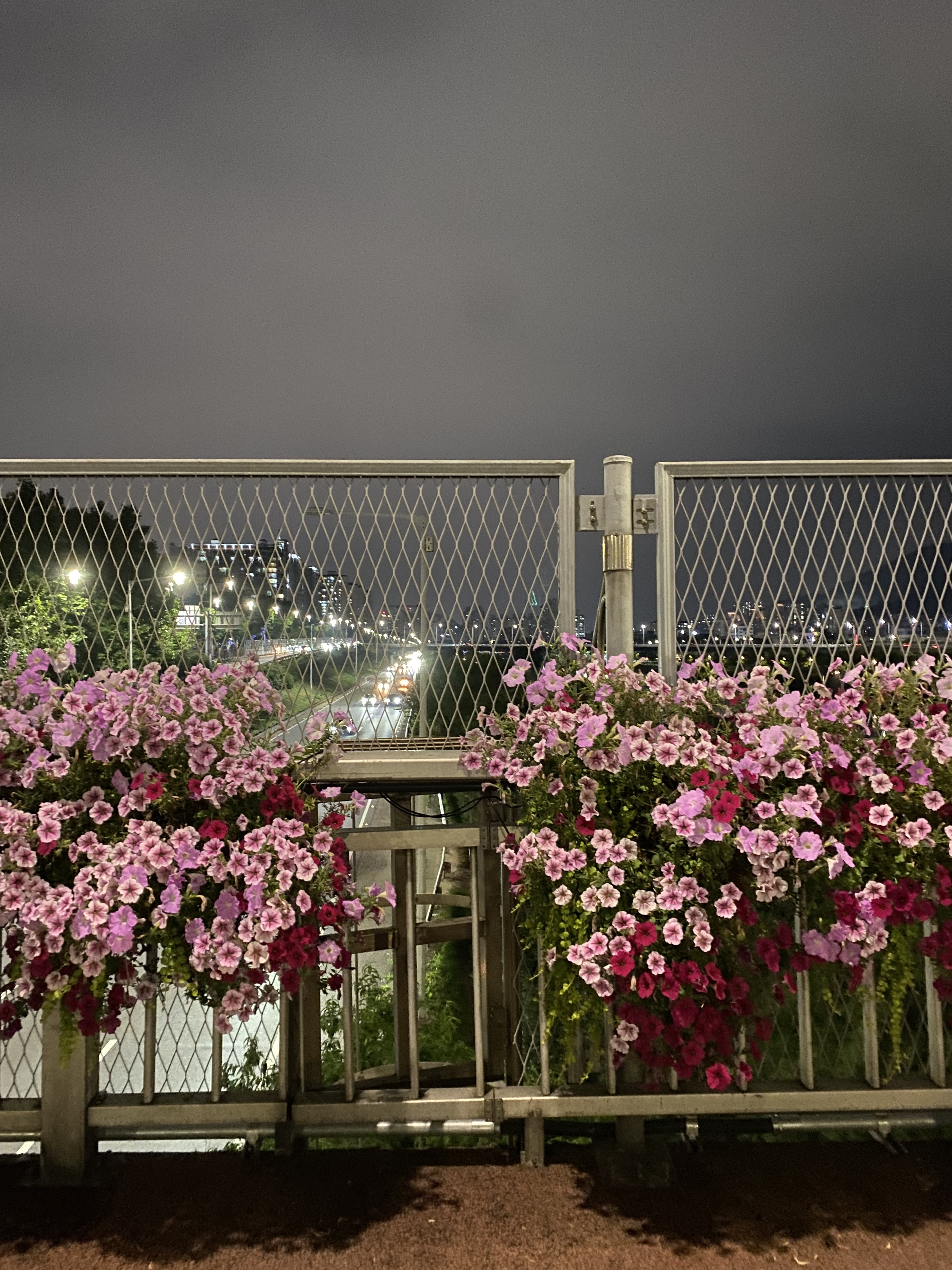
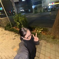
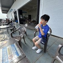
Route photos
![Photo 1 of the Bikemap route "명륜2가 125-2Ph0]으로 라우팅"](https://media.bikemap.net/routes/14650551/gallery/thumbs/070e19b9-362e-43fe-b1ec-650f6cd2c9c0.jpg.688x400_q80_crop.jpg "Photo 1 of the Bikemap route \"명륜2가 125-2Ph0]으로 라우팅\"")
![Photo 2 of the Bikemap route "명륜2가 125-2Ph0]으로 라우팅"](https://media.bikemap.net/routes/14650551/gallery/thumbs/58438831-c0bd-496a-bf6c-03c1a3bf25c6.jpg.688x400_q80_crop.jpg "Photo 2 of the Bikemap route \"명륜2가 125-2Ph0]으로 라우팅\"")
![Photo 3 of the Bikemap route "명륜2가 125-2Ph0]으로 라우팅"](https://media.bikemap.net/routes/14650551/gallery/thumbs/ecda0387-dc4e-4f9d-a9cb-bfb722d9cd07.jpg.208x208_q80_crop.jpg "Photo 3 of the Bikemap route \"명륜2가 125-2Ph0]으로 라우팅\"")
![Photo 4 of the Bikemap route "명륜2가 125-2Ph0]으로 라우팅"](https://media.bikemap.net/routes/14650551/gallery/thumbs/5ae056b1-5ac6-4d85-998f-28280bbf9592.jpg.208x208_q80_crop.jpg "Photo 4 of the Bikemap route \"명륜2가 125-2Ph0]으로 라우팅\"")
![Photo 5 of the Bikemap route "명륜2가 125-2Ph0]으로 라우팅"](https://media.bikemap.net/routes/14650551/gallery/thumbs/bf2fc111-453c-4cfc-ba13-95c03d97c69a.jpg.208x208_q80_crop.jpg "Photo 5 of the Bikemap route \"명륜2가 125-2Ph0]으로 라우팅\"")
![Photo 6 of the Bikemap route "명륜2가 125-2Ph0]으로 라우팅"](https://media.bikemap.net/routes/14650551/gallery/thumbs/e85bf38a-baeb-495b-b50e-f5a498c823c5.jpg.208x208_q80_crop.jpg "Photo 6 of the Bikemap route \"명륜2가 125-2Ph0]으로 라우팅\"")
Route quality
Waytypes & surfaces along the route
Waytypes
Road
29.1 km
(41 %)
Quiet road
17 km
(24 %)
Surfaces
Paved
22.7 km
(32 %)
Unpaved
2.1 km
(3 %)
Asphalt
22.7 km
(32 %)
Ground
2.1 km
(3 %)
Undefined
46.1 km
(65 %)
Continue with Bikemap
Use, edit, or download this cycling route
You would like to ride 명륜2가 125-2Ph0]으로 라우팅 or customize it for your own trip? Here is what you can do with this Bikemap route:
Free features
- Save this route as favorite or in collections
- Copy & plan your own version of this route
- Sync your route with Garmin or Wahoo
Premium features
Free trial for 3 days, or one-time payment. More about Bikemap Premium.
- Navigate this route on iOS & Android
- Export a GPX / KML file of this route
- Create your custom printout (try it for free)
- Download this route for offline navigation
Discover more Premium features.
Get Bikemap PremiumFrom our community
Other popular routes starting in Seoul
 북부간선도로, 서울특별시에서 월곡로14길, 서울특별시까지
- Distance
- 19.1 km
- Ascent
- 409 m
- Descent
- 422 m
- Location
- Seoul, Seoul, South Korea
 1 Seonwon - Hanam
- Distance
- 64.5 km
- Ascent
- 722 m
- Descent
- 723 m
- Location
- Seoul, Seoul, South Korea
 노량진동, 서울특별시 to 노량진동, 서울특별시
- Distance
- 56.3 km
- Ascent
- 432 m
- Descent
- 429 m
- Location
- Seoul, Seoul, South Korea
 잠원로, 서울특별시에서 방배동, 서울특별시까지
- Distance
- 30.1 km
- Ascent
- 203 m
- Descent
- 215 m
- Location
- Seoul, Seoul, South Korea
 토정동, 서울특별시 to 불광동, 서울특별시
- Distance
- 34.8 km
- Ascent
- 1,056 m
- Descent
- 1,038 m
- Location
- Seoul, Seoul, South Korea
 신반포로, 서울특별시에서 방배로, 서울특별시까지
- Distance
- 27.9 km
- Ascent
- 240 m
- Descent
- 234 m
- Location
- Seoul, Seoul, South Korea
 잠원동, 서울특별시에서 잠원로, 서울특별시까지
- Distance
- 8.1 km
- Ascent
- 112 m
- Descent
- 115 m
- Location
- Seoul, Seoul, South Korea
 노량진동, 서울특별시 to 노량진동, 서울특별시
- Distance
- 28.2 km
- Ascent
- 204 m
- Descent
- 199 m
- Location
- Seoul, Seoul, South Korea
Open it in the app