

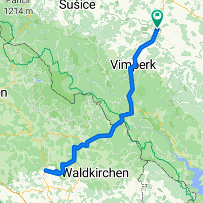
Volyně - Čestice - Vacov - Rohanov -Javorník - Ždánov - hrad Kašperk - Annín - Sušice
A cycling route starting in Volyně, Jihočeský kraj, Czechia.
Overview
About this route
Po turistické modré od Klostermannovy rozhledny na Javorníku se na kole téměř nedá jet, díky kamenům a kořenům. Po několika stech metrech již cesta pěkná. Odtud směrem na bývalý Ždánov je naučná stezka o zdejší vojenské obraně, při cestě zachováno několik betonových bunkrů.
- -:--
- Duration
- 51.7 km
- Distance
- 803 m
- Ascent
- 781 m
- Descent
- ---
- Avg. speed
- ---
- Max. altitude

Route quality
Waytypes & surfaces along the route
Waytypes
Track
12 km
(23 %)
Quiet road
9.5 km
(18 %)
Surfaces
Paved
15.9 km
(31 %)
Unpaved
13.1 km
(25 %)
Asphalt
15 km
(29 %)
Loose gravel
4.6 km
(9 %)
Continue with Bikemap
Use, edit, or download this cycling route
You would like to ride Volyně - Čestice - Vacov - Rohanov -Javorník - Ždánov - hrad Kašperk - Annín - Sušice or customize it for your own trip? Here is what you can do with this Bikemap route:
Free features
- Save this route as favorite or in collections
- Copy & plan your own version of this route
- Sync your route with Garmin or Wahoo
Premium features
Free trial for 3 days, or one-time payment. More about Bikemap Premium.
- Navigate this route on iOS & Android
- Export a GPX / KML file of this route
- Create your custom printout (try it for free)
- Download this route for offline navigation
Discover more Premium features.
Get Bikemap PremiumFrom our community
Other popular routes starting in Volyně
 2020_04 Čestice - Volyně pěšky
- Distance
- 9.5 km
- Ascent
- 452 m
- Descent
- 530 m
- Location
- Volyně, Jihočeský kraj, Czechia
 Lido di Jesolo 604 km
- Distance
- 604.6 km
- Ascent
- 3,804 m
- Descent
- 4,307 m
- Location
- Volyně, Jihočeský kraj, Czechia
 Třístoličník přes Libín a zpět Strážný
- Distance
- 142.9 km
- Ascent
- 1,601 m
- Descent
- 1,605 m
- Location
- Volyně, Jihočeský kraj, Czechia
 Volyňská kolečka - vrchařská průprava
- Distance
- 3.5 km
- Ascent
- 90 m
- Descent
- 90 m
- Location
- Volyně, Jihočeský kraj, Czechia
 Po zelené do Strakonic
- Distance
- 12.6 km
- Ascent
- 165 m
- Descent
- 365 m
- Location
- Volyně, Jihočeský kraj, Czechia
 Volyně - Čkyně
- Distance
- 11.8 km
- Ascent
- 167 m
- Descent
- 95 m
- Location
- Volyně, Jihočeský kraj, Czechia
 Titling MTB závod
- Distance
- 166.1 km
- Ascent
- 1,706 m
- Descent
- 1,711 m
- Location
- Volyně, Jihočeský kraj, Czechia
 Luzný
Luzný- Distance
- 96 km
- Ascent
- 1,731 m
- Descent
- 1,728 m
- Location
- Volyně, Jihočeský kraj, Czechia
Open it in the app