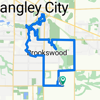
Fairly easy new guy training route
- 15 km
- 95 m
- 95 m
- Township of Langley, British Columbia, Canada
A cycling route starting in Township of Langley, British Columbia, Canada.
Overview
Two hills 20 metre elevation change make for good gearing practice.
created this 13 years ago
Route quality
Quiet road
5.1 km
(34 %)
Road
0.7 km
(5 %)
Paved
6.4 km
(43 %)
Asphalt
3.6 km
(24 %)
Paved (undefined)
2.8 km
(19 %)
Undefined
8.5 km
(57 %)
Continue with Bikemap
You would like to ride Fairly easy new guy training route or customize it for your own trip? Here is what you can do with this Bikemap route:
Free trial for 3 days, or one-time payment. More about Bikemap Premium.
Discover more Premium features.
Get Bikemap PremiumFrom our community
Open it in the app