

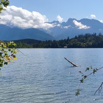
Klamm - Ehrwald
A cycling route starting in Leutasch, Tyrol, Austria.
Overview
About this route
- -:--
- Duration
- 22.8 km
- Distance
- 544 m
- Ascent
- 544 m
- Descent
- ---
- Avg. speed
- ---
- Max. altitude
Route quality
Waytypes & surfaces along the route
Waytypes
Track
22.8 km
(100 %)
Surfaces
Paved
0.2 km
(1 %)
Unpaved
22.8 km
(100 %)
Gravel
20.1 km
(88 %)
Pebblestone
2.7 km
(12 %)
Continue with Bikemap
Use, edit, or download this cycling route
You would like to ride Klamm - Ehrwald or customize it for your own trip? Here is what you can do with this Bikemap route:
Free features
- Save this route as favorite or in collections
- Copy & plan your own version of this route
- Sync your route with Garmin or Wahoo
Premium features
Free trial for 3 days, or one-time payment. More about Bikemap Premium.
- Navigate this route on iOS & Android
- Export a GPX / KML file of this route
- Create your custom printout (try it for free)
- Download this route for offline navigation
Discover more Premium features.
Get Bikemap PremiumFrom our community
Other popular routes starting in Leutasch
 Entspannte Route
- Distance
- 41.9 km
- Ascent
- 567 m
- Descent
- 590 m
- Location
- Leutasch, Tyrol, Austria
 Wettersteinrunde - Moser Tour Nr 37 CLONED FROM ROUTE 47855 CLONED FROM ROUTE 512664
- Distance
- 75.4 km
- Ascent
- 1,503 m
- Descent
- 1,503 m
- Location
- Leutasch, Tyrol, Austria
 Leutasch - Seebensee
- Distance
- 20.5 km
- Ascent
- 608 m
- Descent
- 67 m
- Location
- Leutasch, Tyrol, Austria
 MTB zum Seebensee
- Distance
- 34.4 km
- Ascent
- 633 m
- Descent
- 633 m
- Location
- Leutasch, Tyrol, Austria
 Ahrnspitzrunde Elmau Kranzbergrunde
- Distance
- 50.5 km
- Ascent
- 516 m
- Descent
- 519 m
- Location
- Leutasch, Tyrol, Austria
 Klamm - Ehrwald
- Distance
- 22.8 km
- Ascent
- 544 m
- Descent
- 544 m
- Location
- Leutasch, Tyrol, Austria
 Kühtai
- Distance
- 117 km
- Ascent
- 2,486 m
- Descent
- 2,504 m
- Location
- Leutasch, Tyrol, Austria
 Von Leutasch / Salzbach durch's Gaistal zum Seebensee
- Distance
- 29.2 km
- Ascent
- 675 m
- Descent
- 677 m
- Location
- Leutasch, Tyrol, Austria
Open it in the app