

Emmendingen-Freiamt
A cycling route starting in Emmendingen, Baden-Wurttemberg, Germany.
Overview
About this route
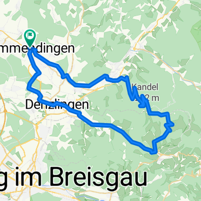
Relatively easy mountain tour through Freiamt with a nice descent to Malterdingen. There are also some longer flatland sections.Downside: You have to go through the town of Emmendingen or go around it.
Maximum gradient: 13% (Hochburg)
- -:--
- Duration
- 43.4 km
- Distance
- 337 m
- Ascent
- 337 m
- Descent
- ---
- Avg. speed
- ---
- Max. altitude

Route quality
Waytypes & surfaces along the route
Waytypes
Road
10.9 km
(25 %)
Quiet road
6.5 km
(15 %)
Surfaces
Paved
29.5 km
(68 %)
Unpaved
0.4 km
(1 %)
Asphalt
29.5 km
(68 %)
Ground
0.4 km
(1 %)
Undefined
13.5 km
(31 %)
Continue with Bikemap
Use, edit, or download this cycling route
You would like to ride Emmendingen-Freiamt or customize it for your own trip? Here is what you can do with this Bikemap route:
Free features
- Save this route as favorite or in collections
- Copy & plan your own version of this route
- Sync your route with Garmin or Wahoo
Premium features
Free trial for 3 days, or one-time payment. More about Bikemap Premium.
- Navigate this route on iOS & Android
- Export a GPX / KML file of this route
- Create your custom printout (try it for free)
- Download this route for offline navigation
Discover more Premium features.
Get Bikemap PremiumFrom our community
Other popular routes starting in Emmendingen
 Test Emmendingen
- Distance
- 2.7 km
- Ascent
- 0 m
- Descent
- 8 m
- Location
- Emmendingen, Baden-Wurttemberg, Germany
 Lessingstraße 7A nach Ensisheimer Straße beste Route
- Distance
- 15.9 km
- Ascent
- 72 m
- Descent
- 33 m
- Location
- Emmendingen, Baden-Wurttemberg, Germany
 Mundenhof
- Distance
- 56.2 km
- Ascent
- 250 m
- Descent
- 244 m
- Location
- Emmendingen, Baden-Wurttemberg, Germany
 Emmendingen-Freiamt
- Distance
- 43.4 km
- Ascent
- 337 m
- Descent
- 337 m
- Location
- Emmendingen, Baden-Wurttemberg, Germany
 Zug und MTB-Tour Tuttlingen, Stuttgart, Pforzheim
- Distance
- 650.2 km
- Ascent
- 1,746 m
- Descent
- 1,748 m
- Location
- Emmendingen, Baden-Wurttemberg, Germany
 Schillingerbergrunde
- Distance
- 35 km
- Ascent
- 841 m
- Descent
- 781 m
- Location
- Emmendingen, Baden-Wurttemberg, Germany
 EM-Hünersedel
- Distance
- 50.6 km
- Ascent
- 848 m
- Descent
- 846 m
- Location
- Emmendingen, Baden-Wurttemberg, Germany
 EM - Kandel -EM
- Distance
- 54.4 km
- Ascent
- 994 m
- Descent
- 994 m
- Location
- Emmendingen, Baden-Wurttemberg, Germany
Open it in the app