Südfrankreich 2012 - 7: Alès - Florac
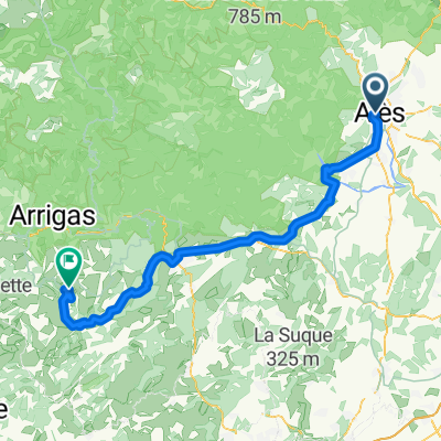
A cycling route starting in Alès, Occitanie, France.
Overview
About this route
Via St. Jean-du-Gard, Vallée Française and Barre-des-Cévennes. Very scenic route through the extremely idyllic Cévennes. The toughest climb starting around km 55 towards Barre-des-Cévennes and the Col du Rey. At the end, a fast descent with a counter-climb to Florac. Possibility to refuel in Saint-Jean-du-Gard and Barre-des-Cévennes. Our cycle computer showed 84 km and 1261 m of elevation gain at the end.
- -:--
- Duration
- 82.1 km
- Distance
- 1,143 m
- Ascent
- 742 m
- Descent
- ---
- Avg. speed
- ---
- Max. altitude
Route quality
Waytypes & surfaces along the route
Waytypes
Road
45.1 km
(55 %)
Quiet road
0.8 km
(1 %)
Surfaces
Paved
61.6 km
(75 %)
Unpaved
0.8 km
(1 %)
Asphalt
61.6 km
(75 %)
Unpaved (undefined)
0.8 km
(1 %)
Undefined
19.7 km
(24 %)
Continue with Bikemap
Use, edit, or download this cycling route
You would like to ride Südfrankreich 2012 - 7: Alès - Florac or customize it for your own trip? Here is what you can do with this Bikemap route:
Free features
- Save this route as favorite or in collections
- Copy & plan your own version of this route
- Split it into stages to create a multi-day tour
- Sync your route with Garmin or Wahoo
Premium features
Free trial for 3 days, or one-time payment. More about Bikemap Premium.
- Navigate this route on iOS & Android
- Export a GPX / KML file of this route
- Create your custom printout (try it for free)
- Download this route for offline navigation
Discover more Premium features.
Get Bikemap PremiumFrom our community
Other popular routes starting in Alès
- Balade 2016 projet
- Distance
- 562.1 km
- Ascent
- 1,678 m
- Descent
- 1,692 m
- Location
- Alès, Occitanie, France
- Par le col de Porte
- Distance
- 64.3 km
- Ascent
- 1,024 m
- Descent
- 996 m
- Location
- Alès, Occitanie, France
- Boucle alésienne
- Distance
- 102 km
- Ascent
- 1,442 m
- Descent
- 1,442 m
- Location
- Alès, Occitanie, France
- CevennenAlpenTour2022_E4
- Distance
- 111.7 km
- Ascent
- 1,136 m
- Descent
- 1,063 m
- Location
- Alès, Occitanie, France
- Paris - Nice : 5. Alès - Uzès (ITT)
- Distance
- 46 km
- Ascent
- 604 m
- Descent
- 621 m
- Location
- Alès, Occitanie, France
- Stage 5 - Étoile de Bessèges 2014 - Alès-Alès
- Distance
- 10.6 km
- Ascent
- 213 m
- Descent
- 79 m
- Location
- Alès, Occitanie, France
- Boucle alésienne
- Distance
- 102 km
- Ascent
- 1,494 m
- Descent
- 1,494 m
- Location
- Alès, Occitanie, France
- Relaxed route in Alès
- Distance
- 8.9 km
- Ascent
- 78 m
- Descent
- 72 m
- Location
- Alès, Occitanie, France
Open it in the app