

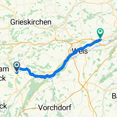
Kematen Scharten Marchtrenk
A cycling route starting in Aichkirchen, Upper Austria, Austria.
Overview
About this route
- -:--
- Duration
- 84.2 km
- Distance
- 433 m
- Ascent
- 433 m
- Descent
- ---
- Avg. speed
- ---
- Max. altitude
Route quality
Waytypes & surfaces along the route
Waytypes
Quiet road
28.6 km
(34 %)
Road
27.8 km
(33 %)
Surfaces
Paved
25.3 km
(30 %)
Asphalt
24.4 km
(29 %)
Paved (undefined)
0.8 km
(1 %)
Undefined
58.9 km
(70 %)
Continue with Bikemap
Use, edit, or download this cycling route
You would like to ride Kematen Scharten Marchtrenk or customize it for your own trip? Here is what you can do with this Bikemap route:
Free features
- Save this route as favorite or in collections
- Copy & plan your own version of this route
- Split it into stages to create a multi-day tour
- Sync your route with Garmin or Wahoo
Premium features
Free trial for 3 days, or one-time payment. More about Bikemap Premium.
- Navigate this route on iOS & Android
- Export a GPX / KML file of this route
- Create your custom printout (try it for free)
- Download this route for offline navigation
Discover more Premium features.
Get Bikemap PremiumFrom our community
Other popular routes starting in Aichkirchen
 Proberunde
- Distance
- 17.2 km
- Ascent
- 136 m
- Descent
- 144 m
- Location
- Aichkirchen, Upper Austria, Austria
 Reiterrunde
- Distance
- 59.7 km
- Ascent
- 469 m
- Descent
- 506 m
- Location
- Aichkirchen, Upper Austria, Austria
 Kaitingerstraße 2–6, Niederthalheim nach Antoniusweg 11, Niederthalheim
- Distance
- 11.4 km
- Ascent
- 192 m
- Descent
- 164 m
- Location
- Aichkirchen, Upper Austria, Austria
 Bergstraße nach Welser Straße
- Distance
- 37.1 km
- Ascent
- 129 m
- Descent
- 259 m
- Location
- Aichkirchen, Upper Austria, Austria
 Hauptstraße 45–49, Niederthalheim nach Rüstorf 47, Rüstorf
- Distance
- 9.9 km
- Ascent
- 41 m
- Descent
- 78 m
- Location
- Aichkirchen, Upper Austria, Austria
 Kematen Scharten Marchtrenk
- Distance
- 84.2 km
- Ascent
- 433 m
- Descent
- 433 m
- Location
- Aichkirchen, Upper Austria, Austria
 Voggenberg-test
- Distance
- 85.6 km
- Ascent
- 1,032 m
- Descent
- 1,444 m
- Location
- Aichkirchen, Upper Austria, Austria
 Test Aichkirchen
- Distance
- 44.7 km
- Ascent
- 446 m
- Descent
- 439 m
- Location
- Aichkirchen, Upper Austria, Austria
Open it in the app