
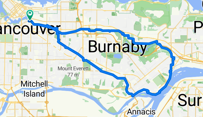
Central Valley Greenway / BC Parkway
A cycling route starting in Vancouver, British Columbia, Canada.
Overview
About this route
Mostly dedicated bike paths. Some shared paths with pedestrians and others with vehicles. The few gravel sections are flat and well maintained, and can be done with a road bike if you have experience with that kind of terrain.
- 2 h 39 min
- Duration
- 44 km
- Distance
- 440 m
- Ascent
- 443 m
- Descent
- 16.6 km/h
- Avg. speed
- 156 m
- Max. altitude
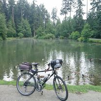
Route photos


Route quality
Waytypes & surfaces along the route
Waytypes
Cycleway
32.1 km
(73 %)
Road
5.7 km
(13 %)
Surfaces
Paved
39.1 km
(89 %)
Unpaved
4 km
(9 %)
Asphalt
34.3 km
(78 %)
Paved (undefined)
4 km
(9 %)
Continue with Bikemap
Use, edit, or download this cycling route
You would like to ride Central Valley Greenway / BC Parkway or customize it for your own trip? Here is what you can do with this Bikemap route:
Free features
- Save this route as favorite or in collections
- Copy & plan your own version of this route
- Sync your route with Garmin or Wahoo
Premium features
Free trial for 3 days, or one-time payment. More about Bikemap Premium.
- Navigate this route on iOS & Android
- Export a GPX / KML file of this route
- Create your custom printout (try it for free)
- Download this route for offline navigation
Discover more Premium features.
Get Bikemap PremiumFrom our community
Other popular routes starting in Vancouver
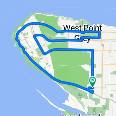
 deer lake loop
- Distance
- 17.8 km
- Ascent
- 320 m
- Descent
- 320 m
- Location
- Vancouver, British Columbia, Canada
 100 K Loop
- Distance
- 108.1 km
- Ascent
- 333 m
- Descent
- 335 m
- Location
- Vancouver, British Columbia, Canada
 Long bike tour through Vancouver
- Distance
- 37.2 km
- Ascent
- 428 m
- Descent
- 428 m
- Location
- Vancouver, British Columbia, Canada
 Parkway/Greenway Loop
- Distance
- 38.7 km
- Ascent
- 391 m
- Descent
- 391 m
- Location
- Vancouver, British Columbia, Canada
 Seawall
- Distance
- 20.4 km
- Ascent
- 473 m
- Descent
- 475 m
- Location
- Vancouver, British Columbia, Canada
 ride through Vancouver
- Distance
- 24.8 km
- Ascent
- 168 m
- Descent
- 168 m
- Location
- Vancouver, British Columbia, Canada
 WE, Vancouver to Cypress XC Area
- Distance
- 71.4 km
- Ascent
- 1,722 m
- Descent
- 1,723 m
- Location
- Vancouver, British Columbia, Canada
 Crown-UBC-4th Ave Hill circuit
- Distance
- 24.8 km
- Ascent
- 235 m
- Descent
- 236 m
- Location
- Vancouver, British Columbia, Canada
Open it in the app