Bad Kreuznach - Kirn Papiermühle
A cycling route starting in Bretzenheim, Rhineland-Palatinate, Germany.
Overview
About this route
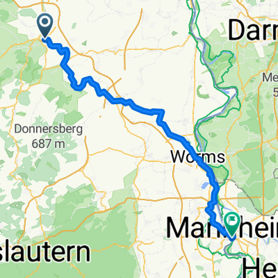
Return from a Permanent RTF of RC Michelin Bad Kreuznach e.V. to Kirn to the Papiermühle campsite
- -:--
- Duration
- 46.4 km
- Distance
- 260 m
- Ascent
- 147 m
- Descent
- ---
- Avg. speed
- ---
- Max. altitude
Continue with Bikemap
Use, edit, or download this cycling route
You would like to ride Bad Kreuznach - Kirn Papiermühle or customize it for your own trip? Here is what you can do with this Bikemap route:
Free features
- Save this route as favorite or in collections
- Copy & plan your own version of this route
- Sync your route with Garmin or Wahoo
Premium features
Free trial for 3 days, or one-time payment. More about Bikemap Premium.
- Navigate this route on iOS & Android
- Export a GPX / KML file of this route
- Create your custom printout (try it for free)
- Download this route for offline navigation
Discover more Premium features.
Get Bikemap PremiumFrom our community
Other popular routes starting in Bretzenheim
- Um die Rheinhessische Schweiz - 77 km Permanente des RC Michelin Bad Kreuznach e.V.
- Distance
- 63.9 km
- Ascent
- 470 m
- Descent
- 473 m
- Location
- Bretzenheim, Rhineland-Palatinate, Germany
- Von der Nahe zum Rhein - 72 km Permanente des RC Michelin Bad Kreuznach e.V.
- Distance
- 78.5 km
- Ascent
- 724 m
- Descent
- 706 m
- Location
- Bretzenheim, Rhineland-Palatinate, Germany
- Joggingroute 9,81 KM Planig, Bosenh., Hackenh., Volxh., Pleitersh.
- Distance
- 9.8 km
- Ascent
- 100 m
- Descent
- 60 m
- Location
- Bretzenheim, Rhineland-Palatinate, Germany
- Bad Kreuznach - Kirn Papiermühle
- Distance
- 46.4 km
- Ascent
- 260 m
- Descent
- 147 m
- Location
- Bretzenheim, Rhineland-Palatinate, Germany
- Recovered Route
- Distance
- 42.5 km
- Ascent
- 133 m
- Descent
- 133 m
- Location
- Bretzenheim, Rhineland-Palatinate, Germany
- Am Fuße des Hunsrücks - 74 km Permanente des RC Michelin Bad Kreuznach e.V.
- Distance
- 74.8 km
- Ascent
- 1,172 m
- Descent
- 1,169 m
- Location
- Bretzenheim, Rhineland-Palatinate, Germany
- Hargesheim Guldental MTB Strecke
- Distance
- 17 km
- Ascent
- 184 m
- Descent
- 185 m
- Location
- Bretzenheim, Rhineland-Palatinate, Germany
- Naheweinstraße 54B, Bretzenheim nach Naheweinstraße 54B, Bretzenheim
- Distance
- 14.6 km
- Ascent
- 149 m
- Descent
- 150 m
- Location
- Bretzenheim, Rhineland-Palatinate, Germany
Open it in the app