
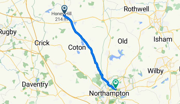
Northampton Road, Welford, Northampton to 159-185 Abington Avenue, Northampton
A cycling route starting in Lutterworth, England, United Kingdom.
Overview
About this route
- 52 min
- Duration
- 23.6 km
- Distance
- 176 m
- Ascent
- 231 m
- Descent
- 27.1 km/h
- Avg. speed
- 184 m
- Max. altitude
Route quality
Waytypes & surfaces along the route
Waytypes
Busy road
19.1 km
(81 %)
Cycleway
2.3 km
(10 %)
Surfaces
Paved
12 km
(51 %)
Asphalt
11.1 km
(47 %)
Paved (undefined)
0.9 km
(4 %)
Undefined
11.6 km
(49 %)
Continue with Bikemap
Use, edit, or download this cycling route
You would like to ride Northampton Road, Welford, Northampton to 159-185 Abington Avenue, Northampton or customize it for your own trip? Here is what you can do with this Bikemap route:
Free features
- Save this route as favorite or in collections
- Copy & plan your own version of this route
- Sync your route with Garmin or Wahoo
Premium features
Free trial for 3 days, or one-time payment. More about Bikemap Premium.
- Navigate this route on iOS & Android
- Export a GPX / KML file of this route
- Create your custom printout (try it for free)
- Download this route for offline navigation
Discover more Premium features.
Get Bikemap PremiumFrom our community
Other popular routes starting in Lutterworth
 NORTH KILWORTH MARINA, Station Road, Lutterworth to Westleigh Farm, North Lane, Market Harborough
- Distance
- 15.2 km
- Ascent
- 95 m
- Descent
- 117 m
- Location
- Lutterworth, England, United Kingdom
 Lutterworth to Gumley Road, Foxton
- Distance
- 11.1 km
- Ascent
- 52 m
- Descent
- 55 m
- Location
- Lutterworth, England, United Kingdom
 Lutterworth Big Ride 39
- Distance
- 62.5 km
- Ascent
- 531 m
- Descent
- 534 m
- Location
- Lutterworth, England, United Kingdom
 Lutterworth Big Ride 67
- Distance
- 106.2 km
- Ascent
- 927 m
- Descent
- 930 m
- Location
- Lutterworth, England, United Kingdom
 10 miles
- Distance
- 16.8 km
- Ascent
- 98 m
- Descent
- 100 m
- Location
- Lutterworth, England, United Kingdom
 Off to Tur Langton
- Distance
- 58.4 km
- Ascent
- 333 m
- Descent
- 333 m
- Location
- Lutterworth, England, United Kingdom
 Ride with Ant
- Distance
- 28.5 km
- Ascent
- 145 m
- Descent
- 138 m
- Location
- Lutterworth, England, United Kingdom
 Local TT Route
- Distance
- 16.4 km
- Ascent
- 81 m
- Descent
- 81 m
- Location
- Lutterworth, England, United Kingdom
Open it in the app