

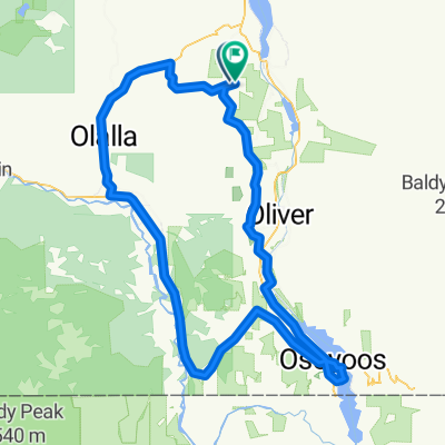
Keremeos to Osoyoos -Actual
A cycling route starting in Oliver, British Columbia, Canada.
Overview
About this route
Great ride through beautiful scenic countryside. Highway 3 (Crowsnest Highway) has great road shoulder, especially from the turnoff for Nighthawk Road all the way into Osoyoos. While there was plenty of traffic on Highway 3, it wasn't as bad in this section as it was west of Princeton..
- 5 h 1 min
- Duration
- 50.1 km
- Distance
- 663 m
- Ascent
- 798 m
- Descent
- 10 km/h
- Avg. speed
- 687 m
- Max. altitude

Route photos


Route quality
Waytypes & surfaces along the route
Waytypes
Cycleway
42.1 km
(84 %)
Quiet road
6.5 km
(13 %)
Surfaces
Paved
17 km
(34 %)
Asphalt
17 km
(34 %)
Undefined
33.1 km
(66 %)
Continue with Bikemap
Use, edit, or download this cycling route
You would like to ride Keremeos to Osoyoos -Actual or customize it for your own trip? Here is what you can do with this Bikemap route:
Free features
- Save this route as favorite or in collections
- Copy & plan your own version of this route
- Sync your route with Garmin or Wahoo
Premium features
Free trial for 3 days, or one-time payment. More about Bikemap Premium.
- Navigate this route on iOS & Android
- Export a GPX / KML file of this route
- Create your custom printout (try it for free)
- Download this route for offline navigation
Discover more Premium features.
Get Bikemap PremiumFrom our community
Other popular routes starting in Oliver
 2018-05: Oliver to Princeton
- Distance
- 101.9 km
- Ascent
- 1,075 m
- Descent
- 733 m
- Location
- Oliver, British Columbia, Canada
 Richters Pass and the Rollers
- Distance
- 55.4 km
- Ascent
- 556 m
- Descent
- 460 m
- Location
- Oliver, British Columbia, Canada
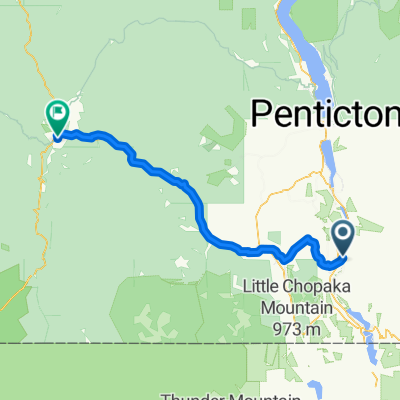
 From Oliver to Penticton
- Distance
- 46.2 km
- Ascent
- 777 m
- Descent
- 722 m
- Location
- Oliver, British Columbia, Canada
 Oliver - Golden Mile
- Distance
- 39 km
- Ascent
- 223 m
- Descent
- 445 m
- Location
- Oliver, British Columbia, Canada
 Tour of the South Okanagan
- Distance
- 129.7 km
- Ascent
- 1,498 m
- Descent
- 1,508 m
- Location
- Oliver, British Columbia, Canada
 groovy reunion day 1
- Distance
- 47.2 km
- Ascent
- 449 m
- Descent
- 442 m
- Location
- Oliver, British Columbia, Canada
 Green Lake Rd OK Falls 50k
- Distance
- 51 km
- Ascent
- 574 m
- Descent
- 570 m
- Location
- Oliver, British Columbia, Canada
 DRAO loop
- Distance
- 32.2 km
- Ascent
- 466 m
- Descent
- 467 m
- Location
- Oliver, British Columbia, Canada
Open it in the app