Erozheim und zurück
- 58.3 km
- 329 m
- 329 m
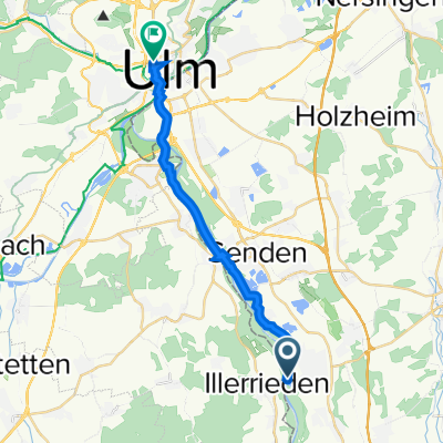
- Illerrieden, Baden-Wurttemberg, Germany
A cycling route starting in Illerrieden, Baden-Wurttemberg, Germany.
Overview
Start in Illerrieden - Golf course Wain - Weihungszell - Illerrieden; optional sprint at the end through Illertissen
created this 13 years ago
Route quality
Track
23.9 km
(47 %)
Path
9.7 km
(19 %)
Paved
19.9 km
(39 %)
Unpaved
21.4 km
(42 %)
Asphalt
17.8 km
(35 %)
Gravel
15.3 km
(30 %)
Continue with Bikemap
You would like to ride Iller-Wain-Weihungszell or customize it for your own trip? Here is what you can do with this Bikemap route:
Free trial for 3 days, or one-time payment. More about Bikemap Premium.
Discover more Premium features.
Get Bikemap PremiumFrom our community
Open it in the app