

Wenn man sich im Rotbachtal verfährt !!
A cycling route starting in Meiderich, North Rhine-Westphalia, Germany.
Overview
About this route
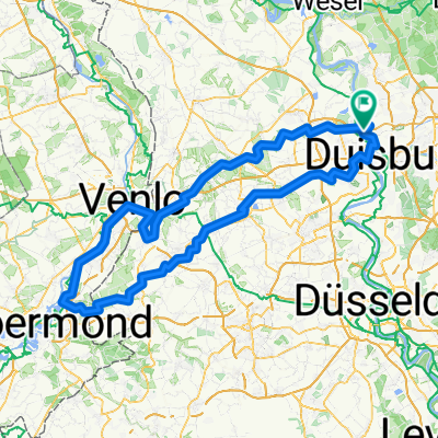
Wenn man sich im Rotbachtal verfährt !!
- -:--
- Duration
- 24.2 km
- Distance
- 110 m
- Ascent
- 84 m
- Descent
- ---
- Avg. speed
- ---
- Max. altitude

Continue with Bikemap
Use, edit, or download this cycling route
You would like to ride Wenn man sich im Rotbachtal verfährt !! or customize it for your own trip? Here is what you can do with this Bikemap route:
Free features
- Save this route as favorite or in collections
- Copy & plan your own version of this route
- Sync your route with Garmin or Wahoo
Premium features
Free trial for 3 days, or one-time payment. More about Bikemap Premium.
- Navigate this route on iOS & Android
- Export a GPX / KML file of this route
- Create your custom printout (try it for free)
- Download this route for offline navigation
Discover more Premium features.
Get Bikemap PremiumFrom our community
Other popular routes starting in Meiderich
 Ruhrtalradweg
- Distance
- 226.5 km
- Ascent
- 798 m
- Descent
- 167 m
- Location
- Meiderich, North Rhine-Westphalia, Germany
 Ruhrtal-Baldeneysee-Runde 3
- Distance
- 62.4 km
- Ascent
- 185 m
- Descent
- 184 m
- Location
- Meiderich, North Rhine-Westphalia, Germany
 Graf Mühle - Rotbach - Orsoy - Ruhrort
- Distance
- 70.5 km
- Ascent
- 97 m
- Descent
- 100 m
- Location
- Meiderich, North Rhine-Westphalia, Germany
 HOAG-Route - Grüner Pfad (geschlossen am Rhein)
- Distance
- 32.5 km
- Ascent
- 83 m
- Descent
- 84 m
- Location
- Meiderich, North Rhine-Westphalia, Germany
 Rheinberg
- Distance
- 18.7 km
- Ascent
- 25 m
- Descent
- 29 m
- Location
- Meiderich, North Rhine-Westphalia, Germany
 Duisburg-Brüggen-Venlo-Kaldenkirchen-Duisburg
- Distance
- 165.9 km
- Ascent
- 203 m
- Descent
- 204 m
- Location
- Meiderich, North Rhine-Westphalia, Germany
 Duisburg Rundtour
- Distance
- 34.6 km
- Ascent
- 58 m
- Descent
- 55 m
- Location
- Meiderich, North Rhine-Westphalia, Germany
 Langsame Fahrt in Oberhausen
- Distance
- 10 km
- Ascent
- 9 m
- Descent
- 9 m
- Location
- Meiderich, North Rhine-Westphalia, Germany
Open it in the app