

Tour zum Hermannsdenkmal
A cycling route starting in Oelde, North Rhine-Westphalia, Germany.
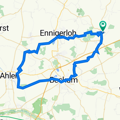
Overview
About this route
unsere traditionelle Tour zum Hermansdenkmal am Karfreitag.
Flache Anfahrt, dann Hügelig und flach wieder zurück
- -:--
- Duration
- 141.8 km
- Distance
- 1,009 m
- Ascent
- 1,024 m
- Descent
- ---
- Avg. speed
- 382 m
- Max. altitude

Route quality
Waytypes & surfaces along the route
Waytypes
Quiet road
42.4 km
(30 %)
Road
29.6 km
(21 %)
Surfaces
Paved
118.7 km
(84 %)
Unpaved
2.9 km
(2 %)
Asphalt
112.6 km
(79 %)
Paving stones
4.3 km
(3 %)
Continue with Bikemap
Use, edit, or download this cycling route
You would like to ride Tour zum Hermannsdenkmal or customize it for your own trip? Here is what you can do with this Bikemap route:
Free features
- Save this route as favorite or in collections
- Copy & plan your own version of this route
- Split it into stages to create a multi-day tour
- Sync your route with Garmin or Wahoo
Premium features
Free trial for 3 days, or one-time payment. More about Bikemap Premium.
- Navigate this route on iOS & Android
- Export a GPX / KML file of this route
- Create your custom printout (try it for free)
- Download this route for offline navigation
Discover more Premium features.
Get Bikemap PremiumFrom our community
Other popular routes starting in Oelde
 MTB-Oelde_Vellern
- Distance
- 39.4 km
- Ascent
- 298 m
- Descent
- 294 m
- Location
- Oelde, North Rhine-Westphalia, Germany
 Rheda-Gütersloh-Cafe Hühnerstall-Marienfeld-Herzebrock-Lönne
- Distance
- 55.6 km
- Ascent
- 220 m
- Descent
- 220 m
- Location
- Oelde, North Rhine-Westphalia, Germany
 Stromberg-Batenhorst-Rheda Wiedenbrück-Spielerei-Herzebrock-Lönne
- Distance
- 47.8 km
- Ascent
- 225 m
- Descent
- 226 m
- Location
- Oelde, North Rhine-Westphalia, Germany
 Ennigerloh-Vorhelm-Langst Zeche Ahlen-Gasthaus Brand Vellern
- Distance
- 53.7 km
- Ascent
- 203 m
- Descent
- 203 m
- Location
- Oelde, North Rhine-Westphalia, Germany
 Keitlinghausen-Wadersloh-Cappel-Lippstadt-Bad Waldliesborn-Langenberg-Alter Hut-Stromberg
- Distance
- 68.9 km
- Ascent
- 365 m
- Descent
- 362 m
- Location
- Oelde, North Rhine-Westphalia, Germany
 Beelen-Peckeloh-Greffen-Clarholz-Lönne
- Distance
- 55.3 km
- Ascent
- 226 m
- Descent
- 226 m
- Location
- Oelde, North Rhine-Westphalia, Germany
 Tour zum Hermannsdenkmal
- Distance
- 141.8 km
- Ascent
- 1,009 m
- Descent
- 1,024 m
- Location
- Oelde, North Rhine-Westphalia, Germany
 Möhler-Herzebrock-Cafe Hühnerstall-Marienfeld-Clarholz
- Distance
- 47.7 km
- Ascent
- 119 m
- Descent
- 120 m
- Location
- Oelde, North Rhine-Westphalia, Germany
Open it in the app