

Ulstertal und Kegelradweg
A cycling route starting in Schenklengsfeld, Hesse, Germany.
Overview
About this route
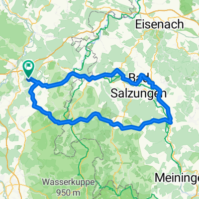
Schenklengsfeld – Ransbach – Ausbach – Heimboldshausen – Röhrigshof – Philippsthal – Unterbreitzbach – Pferdsdorf – Wenigentaft – Treischfeld Großentaft – Leibolz – Fürsteneck – Oberweisenborn – Unterweisenborn - Schenklengsfeld
- -:--
- Duration
- 46.6 km
- Distance
- 242 m
- Ascent
- 243 m
- Descent
- ---
- Avg. speed
- ---
- Max. altitude

Route quality
Waytypes & surfaces along the route
Waytypes
Track
13.5 km
(29 %)
Quiet road
8.4 km
(18 %)
Surfaces
Paved
42.4 km
(91 %)
Unpaved
2.8 km
(6 %)
Asphalt
40.5 km
(87 %)
Gravel
2.8 km
(6 %)
Continue with Bikemap
Use, edit, or download this cycling route
You would like to ride Ulstertal und Kegelradweg or customize it for your own trip? Here is what you can do with this Bikemap route:
Free features
- Save this route as favorite or in collections
- Copy & plan your own version of this route
- Sync your route with Garmin or Wahoo
Premium features
Free trial for 3 days, or one-time payment. More about Bikemap Premium.
- Navigate this route on iOS & Android
- Export a GPX / KML file of this route
- Create your custom printout (try it for free)
- Download this route for offline navigation
Discover more Premium features.
Get Bikemap PremiumFrom our community
Other popular routes starting in Schenklengsfeld
 Rund um die Wippershainer Höhe
- Distance
- 23.9 km
- Ascent
- 302 m
- Descent
- 302 m
- Location
- Schenklengsfeld, Hesse, Germany
 Ulstertal und Kegelradweg
- Distance
- 46.6 km
- Ascent
- 242 m
- Descent
- 243 m
- Location
- Schenklengsfeld, Hesse, Germany
 Königsetappe115
- Distance
- 115.8 km
- Ascent
- 847 m
- Descent
- 834 m
- Location
- Schenklengsfeld, Hesse, Germany
 Königsetappe125
- Distance
- 126.8 km
- Ascent
- 834 m
- Descent
- 834 m
- Location
- Schenklengsfeld, Hesse, Germany
 Hohenroda - Friedewald - Ho
- Distance
- 29.8 km
- Ascent
- 456 m
- Descent
- 460 m
- Location
- Schenklengsfeld, Hesse, Germany
 RR Hohenroda - B. Hersfeld - Ho
- Distance
- 56.6 km
- Ascent
- 777 m
- Descent
- 777 m
- Location
- Schenklengsfeld, Hesse, Germany
 Hohenroda - Vacha - Ho
- Distance
- 27.5 km
- Ascent
- 385 m
- Descent
- 388 m
- Location
- Schenklengsfeld, Hesse, Germany
 Rund um den Landecker und Dreienberg
- Distance
- 28.6 km
- Ascent
- 228 m
- Descent
- 231 m
- Location
- Schenklengsfeld, Hesse, Germany
Open it in the app