
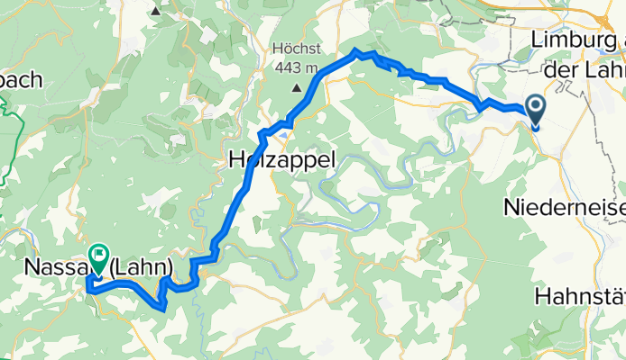
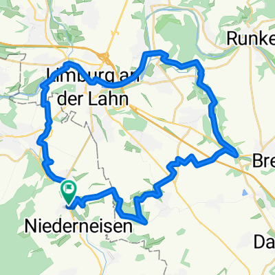
Diez-Göthepunkt-Nassau
A cycling route starting in Holzheim, Rhineland-Palatinate, Germany.
Overview
About this route
- -:--
- Duration
- 27.9 km
- Distance
- 465 m
- Ascent
- 526 m
- Descent
- ---
- Avg. speed
- ---
- Max. altitude

Route quality
Waytypes & surfaces along the route
Waytypes
Track
17.6 km
(63 %)
Quiet road
5.6 km
(20 %)
Surfaces
Paved
13.7 km
(49 %)
Unpaved
9.5 km
(34 %)
Asphalt
13.1 km
(47 %)
Gravel
7.3 km
(26 %)
Continue with Bikemap
Use, edit, or download this cycling route
You would like to ride Diez-Göthepunkt-Nassau or customize it for your own trip? Here is what you can do with this Bikemap route:
Free features
- Save this route as favorite or in collections
- Copy & plan your own version of this route
- Sync your route with Garmin or Wahoo
Premium features
Free trial for 3 days, or one-time payment. More about Bikemap Premium.
- Navigate this route on iOS & Android
- Export a GPX / KML file of this route
- Create your custom printout (try it for free)
- Download this route for offline navigation
Discover more Premium features.
Get Bikemap PremiumFrom our community
Other popular routes starting in Holzheim
 Sonntagstour
- Distance
- 27.6 km
- Ascent
- 440 m
- Descent
- 438 m
- Location
- Holzheim, Rhineland-Palatinate, Germany
 Wingerten; Mensf.; Herin.; Kalt'nhlzh.; B.Schwlb,; Zollh.; Wingerten
- Distance
- 31.8 km
- Ascent
- 335 m
- Descent
- 335 m
- Location
- Holzheim, Rhineland-Palatinate, Germany
 Limburger Radrundweg
- Distance
- 32.9 km
- Ascent
- 318 m
- Descent
- 318 m
- Location
- Holzheim, Rhineland-Palatinate, Germany
 Ins Dörsbachtal über Lahn-Radweg
- Distance
- 63.2 km
- Ascent
- 1,011 m
- Descent
- 1,011 m
- Location
- Holzheim, Rhineland-Palatinate, Germany
 neue Route
- Distance
- 89 km
- Ascent
- 1,121 m
- Descent
- 1,121 m
- Location
- Holzheim, Rhineland-Palatinate, Germany
 20100411
- Distance
- 33.2 km
- Ascent
- 283 m
- Descent
- 283 m
- Location
- Holzheim, Rhineland-Palatinate, Germany
 Erholungstour
- Distance
- 36.3 km
- Ascent
- 660 m
- Descent
- 660 m
- Location
- Holzheim, Rhineland-Palatinate, Germany
 Holzheim>Hohenstein>Breithardt+Zurück
- Distance
- 55.1 km
- Ascent
- 475 m
- Descent
- 473 m
- Location
- Holzheim, Rhineland-Palatinate, Germany
Open it in the app