

1ª Ruta de los Espartanos
A cycling route starting in Sant Vicenç de Castellet, Catalonia, Spain.
Overview
About this route
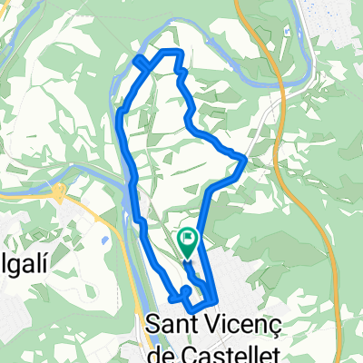
Organized by the Club Ciclista la Bobila de Sant Vicents de Castellet, a spectacular route that takes you from Parc Natural de Sant Llorenç to Parc Natural de la Muntanya de Montserrat, passing through Rellinars, Castellbell i el Vilar, Monistrol, Marganell up to Santa Cecilia, returning to Sant Vicents via Sant Cristofol.
- -:--
- Duration
- 68.2 km
- Distance
- 1,181 m
- Ascent
- 1,181 m
- Descent
- ---
- Avg. speed
- ---
- Max. altitude
Route quality
Waytypes & surfaces along the route
Waytypes
Track
41.6 km
(61 %)
Road
15 km
(22 %)
Surfaces
Paved
11.6 km
(17 %)
Unpaved
34.1 km
(50 %)
Ground
16.4 km
(24 %)
Gravel
13 km
(19 %)
Continue with Bikemap
Use, edit, or download this cycling route
You would like to ride 1ª Ruta de los Espartanos or customize it for your own trip? Here is what you can do with this Bikemap route:
Free features
- Save this route as favorite or in collections
- Copy & plan your own version of this route
- Sync your route with Garmin or Wahoo
Premium features
Free trial for 3 days, or one-time payment. More about Bikemap Premium.
- Navigate this route on iOS & Android
- Export a GPX / KML file of this route
- Create your custom printout (try it for free)
- Download this route for offline navigation
Discover more Premium features.
Get Bikemap PremiumFrom our community
Other popular routes starting in Sant Vicenç de Castellet
 Terme Pont Vilomara per Can Riera
- Distance
- 35.6 km
- Ascent
- 747 m
- Descent
- 748 m
- Location
- Sant Vicenç de Castellet, Catalonia, Spain
 Del Pont al Puig d'en Gil
- Distance
- 5 km
- Ascent
- 473 m
- Descent
- 93 m
- Location
- Sant Vicenç de Castellet, Catalonia, Spain
 Carrer de Jesús, 2, El Pont de Vilomara i Rocafort a Carrer de Jesús, 37, El Pont de Vilomara i Rocafort
- Distance
- 7.9 km
- Ascent
- 84 m
- Descent
- 86 m
- Location
- Sant Vicenç de Castellet, Catalonia, Spain
 1ª Ruta de los Espartanos
- Distance
- 68.2 km
- Ascent
- 1,181 m
- Descent
- 1,181 m
- Location
- Sant Vicenç de Castellet, Catalonia, Spain
 Volta corriol
- Distance
- 7.9 km
- Ascent
- 325 m
- Descent
- 325 m
- Location
- Sant Vicenç de Castellet, Catalonia, Spain
 Volta al Pont de Vilomara, Mura i Talamanca
- Distance
- 56.2 km
- Ascent
- 968 m
- Descent
- 977 m
- Location
- Sant Vicenç de Castellet, Catalonia, Spain
 Sendero Rellinars 2
- Distance
- 0.6 km
- Ascent
- 13 m
- Descent
- 8 m
- Location
- Sant Vicenç de Castellet, Catalonia, Spain
 De Carrer de València 8, Sant Vicenç de Castellet a Carrer de València 8, Sant Vicenç de Castellet
- Distance
- 7.5 km
- Ascent
- 93 m
- Descent
- 103 m
- Location
- Sant Vicenç de Castellet, Catalonia, Spain
Open it in the app