Y-silonka
A cycling route starting in Čadca, Žilina Region, Slovakia.
Overview
About this route
- -:--
- Duration
- 12.2 km
- Distance
- 342 m
- Ascent
- 342 m
- Descent
- ---
- Avg. speed
- ---
- Max. altitude
Route highlights
Points of interest along the route

Point of interest after 2.9 km
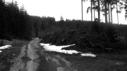
Velmi smutny pohlad

Point of interest after 3 km
?

Point of interest after 3.7 km
Drahošanka...

Point of interest after 3.8 km
Neskutočný výhľad :/

Point of interest after 3.9 km
:/

Point of interest after 4.6 km
Toto nepredáme?
Continue with Bikemap
Use, edit, or download this cycling route
You would like to ride Y-silonka or customize it for your own trip? Here is what you can do with this Bikemap route:
Free features
- Save this route as favorite or in collections
- Copy & plan your own version of this route
- Sync your route with Garmin or Wahoo
Premium features
Free trial for 3 days, or one-time payment. More about Bikemap Premium.
- Navigate this route on iOS & Android
- Export a GPX / KML file of this route
- Create your custom printout (try it for free)
- Download this route for offline navigation
Discover more Premium features.
Get Bikemap PremiumFrom our community
Other popular routes starting in Čadca
 Kysucká magistrála (stredná) mediamatika
- Distance
- 31.9 km
- Ascent
- 533 m
- Descent
- 233 m
- Location
- Čadca, Žilina Region, Slovakia
 Rakovské koliečko
- Distance
- 18.1 km
- Ascent
- 313 m
- Descent
- 312 m
- Location
- Čadca, Žilina Region, Slovakia
 Velky Polom, Husarik
- Distance
- 43.8 km
- Ascent
- 847 m
- Descent
- 848 m
- Location
- Čadca, Žilina Region, Slovakia
 Čadca - Semeteš - Melocik (Makov)
- Distance
- 39.6 km
- Ascent
- 1,418 m
- Descent
- 1,317 m
- Location
- Čadca, Žilina Region, Slovakia
 Zadedova alias Madarske Everest
- Distance
- 14 km
- Ascent
- 369 m
- Descent
- 368 m
- Location
- Čadca, Žilina Region, Slovakia
 Y-silonka
- Distance
- 12.2 km
- Ascent
- 342 m
- Descent
- 342 m
- Location
- Čadca, Žilina Region, Slovakia
 Čadca - Bílá - Pustevny
- Distance
- 57.1 km
- Ascent
- 1,001 m
- Descent
- 398 m
- Location
- Čadca, Žilina Region, Slovakia
 Čadca - Pivovar pod Kyčmolem
- Distance
- 29.5 km
- Ascent
- 428 m
- Descent
- 201 m
- Location
- Čadca, Žilina Region, Slovakia
Open it in the app


