

Hard Boiled Stage 4
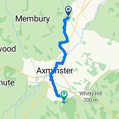
A cycling route starting in Axminster, England, United Kingdom.
Overview
About this route
- -:--
- Duration
- 41 km
- Distance
- 616 m
- Ascent
- 561 m
- Descent
- ---
- Avg. speed
- ---
- Max. altitude
Route quality
Waytypes & surfaces along the route
Waytypes
Quiet road
32 km
(78 %)
Road
3.7 km
(9 %)
Surfaces
Paved
1.2 km
(3 %)
Unpaved
0.4 km
(1 %)
Asphalt
1.2 km
(3 %)
Ground
0.4 km
(1 %)
Undefined
39.4 km
(96 %)
Route highlights
Points of interest along the route
Point of interest after 12.9 km
INFO-8
Point of interest after 29.7 km
INFO-9
Continue with Bikemap
Use, edit, or download this cycling route
You would like to ride Hard Boiled Stage 4 or customize it for your own trip? Here is what you can do with this Bikemap route:
Free features
- Save this route as favorite or in collections
- Copy & plan your own version of this route
- Sync your route with Garmin or Wahoo
Premium features
Free trial for 3 days, or one-time payment. More about Bikemap Premium.
- Navigate this route on iOS & Android
- Export a GPX / KML file of this route
- Create your custom printout (try it for free)
- Download this route for offline navigation
Discover more Premium features.
Get Bikemap PremiumFrom our community
Other popular routes starting in Axminster
 Pilsdon back via Whitchurch and Hawkchurch
- Distance
- 39.6 km
- Ascent
- 1,351 m
- Descent
- 1,355 m
- Location
- Axminster, England, United Kingdom
 Axminster axmouth Axminster
- Distance
- 30.7 km
- Ascent
- 254 m
- Descent
- 289 m
- Location
- Axminster, England, United Kingdom
 Dorset Tour to West Bay
- Distance
- 61.3 km
- Ascent
- 814 m
- Descent
- 814 m
- Location
- Axminster, England, United Kingdom
 axmnster-hawkchurch
- Distance
- 30.1 km
- Ascent
- 421 m
- Descent
- 426 m
- Location
- Axminster, England, United Kingdom
 to Trinity Hill Nature Reserve
- Distance
- 10.5 km
- Ascent
- 257 m
- Descent
- 121 m
- Location
- Axminster, England, United Kingdom
 Cleave Hill, Membury EX13 7AJ
- Distance
- 9.9 km
- Ascent
- 206 m
- Descent
- 73 m
- Location
- Axminster, England, United Kingdom
 Axminster to Dorchester
- Distance
- 57.5 km
- Ascent
- 830 m
- Descent
- 810 m
- Location
- Axminster, England, United Kingdom
 Axminster to Exeter (via Lyme Regis)
- Distance
- 72.9 km
- Ascent
- 879 m
- Descent
- 878 m
- Location
- Axminster, England, United Kingdom
Open it in the app