

Um die Wies
A cycling route starting in Wildsteig, Bavaria, Germany.
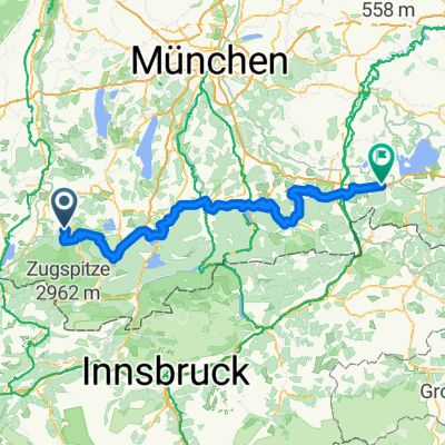
Overview
About this route
Ruhige Runde, auch für Frühjahr geeignet mit einigen Schmankerl,
Einmal über eine Wiese, was nur im Frühjahr möglich ist, wenn auf der Strasse zu viel Schnee liegt. Wenn der Schnee geschmolzen ist, dann ist die Strasse eh besser und ca. 500m länger.
- -:--
- Duration
- 26.3 km
- Distance
- 332 m
- Ascent
- 332 m
- Descent
- ---
- Avg. speed
- ---
- Max. altitude

Route quality
Waytypes & surfaces along the route
Waytypes
Track
13.3 km
(50 %)
Quiet road
11.6 km
(44 %)
Surfaces
Paved
11.7 km
(45 %)
Unpaved
12.8 km
(49 %)
Asphalt
10.4 km
(40 %)
Gravel
8.4 km
(32 %)
Continue with Bikemap
Use, edit, or download this cycling route
You would like to ride Um die Wies or customize it for your own trip? Here is what you can do with this Bikemap route:
Free features
- Save this route as favorite or in collections
- Copy & plan your own version of this route
- Sync your route with Garmin or Wahoo
Premium features
Free trial for 3 days, or one-time payment. More about Bikemap Premium.
- Navigate this route on iOS & Android
- Export a GPX / KML file of this route
- Create your custom printout (try it for free)
- Download this route for offline navigation
Discover more Premium features.
Get Bikemap PremiumFrom our community
Other popular routes starting in Wildsteig
 An der Bleick
- Distance
- 32.1 km
- Ascent
- 788 m
- Descent
- 788 m
- Location
- Wildsteig, Bavaria, Germany
 Groß Bicheleck
- Distance
- 13.6 km
- Ascent
- 237 m
- Descent
- 237 m
- Location
- Wildsteig, Bavaria, Germany
 Bodensee Königssee Radweg
- Distance
- 189 km
- Ascent
- 2,448 m
- Descent
- 2,720 m
- Location
- Wildsteig, Bavaria, Germany
 Tour 2 Bayersoien
- Distance
- 19.7 km
- Ascent
- 287 m
- Descent
- 301 m
- Location
- Wildsteig, Bavaria, Germany
 Wildsteig - Halblech
- Distance
- 25.9 km
- Ascent
- 503 m
- Descent
- 232 m
- Location
- Wildsteig, Bavaria, Germany
 Große Rastrunde
- Distance
- 30.1 km
- Ascent
- 523 m
- Descent
- 523 m
- Location
- Wildsteig, Bavaria, Germany
 Rund um den Staffelsee
- Distance
- 44.6 km
- Ascent
- 317 m
- Descent
- 327 m
- Location
- Wildsteig, Bavaria, Germany
 Wildsteig - Unternogg - Unterammergau - Oberammergau - Graswang - Reutte - Pinswang - Füssen - Wildsteig
- Distance
- 104 km
- Ascent
- 504 m
- Descent
- 505 m
- Location
- Wildsteig, Bavaria, Germany
Open it in the app