

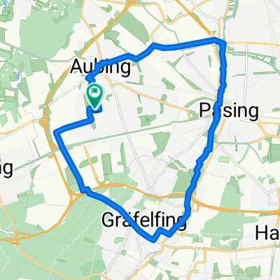
Planegger Straße 3, Germering nach Hans-Mielich-Straße 2, München
A cycling route starting in Germering, Bavaria, Germany.
Overview
About this route
- 1 h 2 min
- Duration
- 18.7 km
- Distance
- 607 m
- Ascent
- 89 m
- Descent
- 18.3 km/h
- Avg. speed
- 552 m
- Avg. speed
Route quality
Waytypes & surfaces along the route
Waytypes
Path
9.6 km
(51 %)
Quiet road
3.8 km
(20 %)
Surfaces
Paved
17.5 km
(93 %)
Unpaved
1.1 km
(6 %)
Asphalt
15.2 km
(81 %)
Paved (undefined)
1.5 km
(8 %)
Continue with Bikemap
Use, edit, or download this cycling route
You would like to ride Planegger Straße 3, Germering nach Hans-Mielich-Straße 2, München or customize it for your own trip? Here is what you can do with this Bikemap route:
Free features
- Save this route as favorite or in collections
- Copy & plan your own version of this route
- Sync your route with Garmin or Wahoo
Premium features
Free trial for 3 days, or one-time payment. More about Bikemap Premium.
- Navigate this route on iOS & Android
- Export a GPX / KML file of this route
- Create your custom printout (try it for free)
- Download this route for offline navigation
Discover more Premium features.
Get Bikemap PremiumFrom our community
Other popular routes starting in Germering
 Germering > Wörthseerunde und zurück
- Distance
- 49.9 km
- Ascent
- 304 m
- Descent
- 274 m
- Location
- Germering, Bavaria, Germany
 von Germering zum Teufelsberg und zurück
- Distance
- 21.1 km
- Ascent
- 112 m
- Descent
- 121 m
- Location
- Germering, Bavaria, Germany
 Route in Germering
- Distance
- 86.2 km
- Ascent
- 733 m
- Descent
- 727 m
- Location
- Germering, Bavaria, Germany
 Germering - Eching - Keltengräber - Germering
- Distance
- 61.4 km
- Ascent
- 343 m
- Descent
- 341 m
- Location
- Germering, Bavaria, Germany
 Pasinger Park
- Distance
- 17.9 km
- Ascent
- 42 m
- Descent
- 43 m
- Location
- Germering, Bavaria, Germany
 Germering - Prittriching Lechaufwärts - Landsberg - Germering
- Distance
- 111.2 km
- Ascent
- 373 m
- Descent
- 373 m
- Location
- Germering, Bavaria, Germany
 Mühltalrunde
- Distance
- 30.4 km
- Ascent
- 217 m
- Descent
- 217 m
- Location
- Germering, Bavaria, Germany
 FFB - Landsberied Dorfwirt - Schöngeising
- Distance
- 40.8 km
- Ascent
- 285 m
- Descent
- 285 m
- Location
- Germering, Bavaria, Germany
Open it in the app