

Rzepedź - Nowy Łupków - Rzepedź
A cycling route starting in Rzepedź, Subcarpathian Voivodeship, Poland.
Overview
About this route
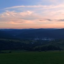
Descent through the Osława valley via Duszatyn, Smolnik, to the 'End of the World' hut in Nowy Łupków. Return via the main road through Komańcza.
- -:--
- Duration
- 45.3 km
- Distance
- 350 m
- Ascent
- 350 m
- Descent
- ---
- Avg. speed
- ---
- Max. altitude

Route quality
Waytypes & surfaces along the route
Waytypes
Quiet road
19 km
(42 %)
Track
7.7 km
(17 %)
Surfaces
Paved
35.8 km
(79 %)
Unpaved
5.9 km
(13 %)
Asphalt
34.9 km
(77 %)
Ground
3.6 km
(8 %)
Continue with Bikemap
Use, edit, or download this cycling route
You would like to ride Rzepedź - Nowy Łupków - Rzepedź or customize it for your own trip? Here is what you can do with this Bikemap route:
Free features
- Save this route as favorite or in collections
- Copy & plan your own version of this route
- Sync your route with Garmin or Wahoo
Premium features
Free trial for 3 days, or one-time payment. More about Bikemap Premium.
- Navigate this route on iOS & Android
- Export a GPX / KML file of this route
- Create your custom printout (try it for free)
- Download this route for offline navigation
Discover more Premium features.
Get Bikemap PremiumFrom our community
Other popular routes starting in Rzepedź
 Turzańsk do Rzepedź przez Suliłe
- Distance
- 10.6 km
- Ascent
- 332 m
- Descent
- 346 m
- Location
- Rzepedź, Subcarpathian Voivodeship, Poland
 Nad jeziorko Bobrowe
- Distance
- 23.2 km
- Ascent
- 366 m
- Descent
- 495 m
- Location
- Rzepedź, Subcarpathian Voivodeship, Poland
 Giro Chryszczata
- Distance
- 47.9 km
- Ascent
- 801 m
- Descent
- 804 m
- Location
- Rzepedź, Subcarpathian Voivodeship, Poland
 Rzepedź - Komańcza - Jawornik
- Distance
- 33 km
- Ascent
- 335 m
- Descent
- 335 m
- Location
- Rzepedź, Subcarpathian Voivodeship, Poland
 Rzepedź do Rzepedź
- Distance
- 41.8 km
- Ascent
- 1,074 m
- Descent
- 1,074 m
- Location
- Rzepedź, Subcarpathian Voivodeship, Poland
 Rzepedź - Nowy Łupków - Rzepedź
- Distance
- 45.3 km
- Ascent
- 350 m
- Descent
- 350 m
- Location
- Rzepedź, Subcarpathian Voivodeship, Poland
 chryszczata
- Distance
- 16.8 km
- Ascent
- 533 m
- Descent
- 530 m
- Location
- Rzepedź, Subcarpathian Voivodeship, Poland
 Rzepedź - Baligród - Rzepedź
- Distance
- 61.1 km
- Ascent
- 745 m
- Descent
- 742 m
- Location
- Rzepedź, Subcarpathian Voivodeship, Poland
Open it in the app