

Pirenaica11. Saint-Lary-Soulan - Vielha
A cycling route starting in Saint-Lary-Soulan, Occitanie, France.
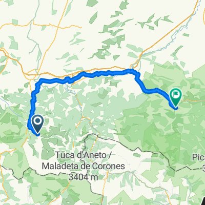
Overview
About this route
5th stage of the Pirenaica 2011 -Col de Peyresourde -Alto del Portillón -Alto de Arres -Sauth deth Pish
- -:--
- Duration
- 105.3 km
- Distance
- 2,737 m
- Ascent
- 2,579 m
- Descent
- ---
- Avg. speed
- ---
- Max. altitude

Route quality
Waytypes & surfaces along the route
Waytypes
Quiet road
33.7 km
(32 %)
Road
12.6 km
(12 %)
Surfaces
Paved
75.8 km
(72 %)
Unpaved
1.1 km
(1 %)
Asphalt
75.8 km
(72 %)
Ground
1.1 km
(1 %)
Undefined
28.4 km
(27 %)
Route highlights
Points of interest along the route
Point of interest after 27.8 km
Col de Peyresourde
Point of interest after 53.1 km
Alto del Portillón
Point of interest after 68.5 km
Alto de Arres
Point of interest after 88.5 km
Sauth deth Pish
Continue with Bikemap
Use, edit, or download this cycling route
You would like to ride Pirenaica11. Saint-Lary-Soulan - Vielha or customize it for your own trip? Here is what you can do with this Bikemap route:
Free features
- Save this route as favorite or in collections
- Copy & plan your own version of this route
- Split it into stages to create a multi-day tour
- Sync your route with Garmin or Wahoo
Premium features
Free trial for 3 days, or one-time payment. More about Bikemap Premium.
- Navigate this route on iOS & Android
- Export a GPX / KML file of this route
- Create your custom printout (try it for free)
- Download this route for offline navigation
Discover more Premium features.
Get Bikemap PremiumFrom our community
Other popular routes starting in Saint-Lary-Soulan
 7. Etappe: Arreau - Luz-Saint-Sauveur
- Distance
- 90.1 km
- Ascent
- 3,015 m
- Descent
- 3,009 m
- Location
- Saint-Lary-Soulan, Occitanie, France
 10.08.07 Col d´Aspin
- Distance
- 42.3 km
- Ascent
- 1,284 m
- Descent
- 1,284 m
- Location
- Saint-Lary-Soulan, Occitanie, France
 Saint-Lary-Soulan - Saint-Girons
- Distance
- 118.8 km
- Ascent
- 1,552 m
- Descent
- 2,016 m
- Location
- Saint-Lary-Soulan, Occitanie, France
 Pirenaica11. Saint-Lary-Soulan - Vielha
- Distance
- 105.3 km
- Ascent
- 2,737 m
- Descent
- 2,579 m
- Location
- Saint-Lary-Soulan, Occitanie, France
 QV A2M S 4+5 (A)
- Distance
- 207.1 km
- Ascent
- 2,531 m
- Descent
- 2,958 m
- Location
- Saint-Lary-Soulan, Occitanie, France
 Sait Lary Soulan-Col d´Azet-Col de Peyresourde-Bagnerés de Luchon-Col du Portillon-Arties
- Distance
- 86 km
- Ascent
- 2,487 m
- Descent
- 2,163 m
- Location
- Saint-Lary-Soulan, Occitanie, France
 11.08.07 Col de Peyresourde
- Distance
- 51.2 km
- Ascent
- 1,051 m
- Descent
- 1,051 m
- Location
- Saint-Lary-Soulan, Occitanie, France
 Etapa 1 Pirineos 2013 (144kms)
- Distance
- 144.1 km
- Ascent
- 0 m
- Descent
- 0 m
- Location
- Saint-Lary-Soulan, Occitanie, France
Open it in the app