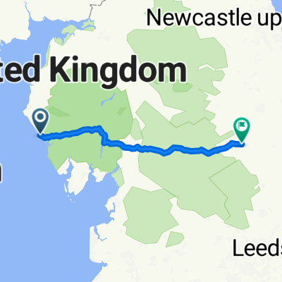
Hadrian's Wall Day 1: Ravenglass to Maryport
- 59.3 km
- 537 m
- 524 m
- Seascale, England, United Kingdom
A cycling route starting in Seascale, England, United Kingdom.
Overview
Great 3 day ride.. Hilly in the middle but nothing too bad. Hybrid ok in the main, some muddy bits in Carlisle. Plent of godd B&B's along the way.
created this 13 years ago
Route quality
Quiet road
83.7 km
(29 %)
Road
75 km
(26 %)
Paved
83.7 km
(29 %)
Unpaved
5.8 km
(2 %)
Asphalt
69.2 km
(24 %)
Paved (undefined)
11.5 km
(4 %)
Route highlights
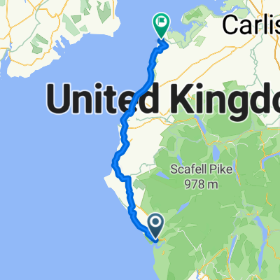
Start of C2C
Wheyrigg Hotel - 1st night B&B
Bowes Inn - 2nd night
Continue with Bikemap
You would like to ride Hadrians Wall Cycle Route 2011 or customize it for your own trip? Here is what you can do with this Bikemap route:
Free trial for 3 days, or one-time payment. More about Bikemap Premium.
Discover more Premium features.
Get Bikemap PremiumFrom our community
Open it in the app