

ÖkoRegio-Tour
A cycling route starting in Jöhlingen, Baden-Wurttemberg, Germany.
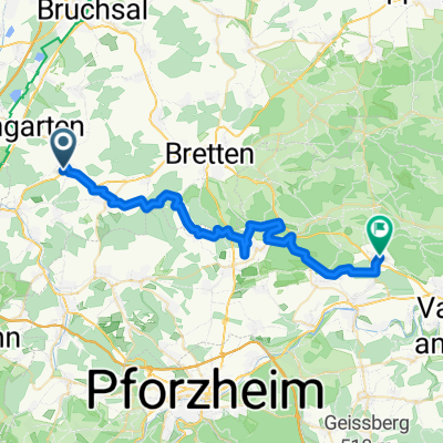
Overview
About this route
Through the Kraichgau: Land and People
On this tour, you'll get up close and personal with the land and its people, often very closely, while seated on your bike saddle. If you wish, we have put together a 75 km circular route for you. However, everyone can choose their favorite section and starting point themselves. The best part: a dozen train stations offer shortcuts by rail if you like (S3/S31/S32 and S4 from Karlsruhe, S9 from Bruchsal).
Many insider tips and highlights await you: Just a few kilometers south of Bruchsal, you ascend Michaelsberg and visit the pilgrimage chapel of the 'Dragon Slayer'. Before you lies the fertile Rhine plain, with views across the river to the Palatinate (Wasgau) and Alsace (Vosges). In good weather, you might even see the Imperial Cathedral of Speyer. It's no wonder that people lived here as early as the Stone Age: ploughed fields of the first farmers recall the 'Michelsberg culture'. At the foot of this cult mountain, it's worth visiting the museum, which tells the story of the first German peasant leader, Joß Fritz (15th/16th century).
Then it becomes moist and pleasantly cool in the gorge forest of Ungeheuerklamm. Botany enthusiasts will find plenty to enjoy here. Much more is still ahead: mysterious hollow ways, dry stone walls, the geological showcase Derdinger Horn, the Faust Museum in Knittlingen, and the historic old town in the Melanchthon city of Bretten. Finally, the route passes through moorland and the 'Hungerquelle' past scattered orchards in the Walzbachtal. In short: the whole wine region from A to Z, from the Amthof of the Cistercian monks (Oberderdingen) to the Sugar Baker Museum (Gochsheim) – and the most charming treasures of the land between Rhine and Neckar: cozy Besenwirtschaften and colorful timber-framed villages, old water castles, and noble wineries...
Tip: 3 nights and 4 days are wrapped up in an appetizing travel package. Regional culinary delights tempt you three evenings. Three delicious packed lunches accompany the tour – and for a small extra charge – the luggage is already at the destination before you arrive. And to make the ÖkoRegio tour environmentally friendly, a train ticket is available on request.
Direct info for this ÖkoRegio bike tour:Kraichgau-Stromberg Tourismus e.V., D-75015 Bretten, Tel. 07252 - 9633 - 0, info@kraichgau-stromberg.com,www.kraichgau-stromberg.com or www.oekoregiotour.de.
- -:--
- Duration
- 68 km
- Distance
- 455 m
- Ascent
- 455 m
- Descent
- ---
- Avg. speed
- ---
- Max. altitude

Route quality
Waytypes & surfaces along the route
Waytypes
Track
27.2 km
(40 %)
Quiet road
25.2 km
(37 %)
Surfaces
Paved
52.4 km
(77 %)
Unpaved
4.8 km
(7 %)
Asphalt
38.1 km
(56 %)
Paved (undefined)
12.9 km
(19 %)
Continue with Bikemap
Use, edit, or download this cycling route
You would like to ride ÖkoRegio-Tour or customize it for your own trip? Here is what you can do with this Bikemap route:
Free features
- Save this route as favorite or in collections
- Copy & plan your own version of this route
- Sync your route with Garmin or Wahoo
Premium features
Free trial for 3 days, or one-time payment. More about Bikemap Premium.
- Navigate this route on iOS & Android
- Export a GPX / KML file of this route
- Create your custom printout (try it for free)
- Download this route for offline navigation
Discover more Premium features.
Get Bikemap PremiumFrom our community
Other popular routes starting in Jöhlingen
 Strecke vom Internationalen Pfinztallauf
- Distance
- 10.3 km
- Ascent
- 36 m
- Descent
- 36 m
- Location
- Jöhlingen, Baden-Wurttemberg, Germany
 Pfinztal-Bulach
- Distance
- 14.7 km
- Ascent
- 45 m
- Descent
- 58 m
- Location
- Jöhlingen, Baden-Wurttemberg, Germany
 Pfinztal-Grenzsägmühle-Ittersbach-Ettlingen-Pfinztal
- Distance
- 51 km
- Ascent
- 331 m
- Descent
- 333 m
- Location
- Jöhlingen, Baden-Wurttemberg, Germany
 Trainingsrunde
- Distance
- 60.1 km
- Ascent
- 482 m
- Descent
- 495 m
- Location
- Jöhlingen, Baden-Wurttemberg, Germany
 Pfinztalrunde
- Distance
- 18.7 km
- Ascent
- 340 m
- Descent
- 342 m
- Location
- Jöhlingen, Baden-Wurttemberg, Germany
 ÖkoRegio-Tour
- Distance
- 68 km
- Ascent
- 455 m
- Descent
- 455 m
- Location
- Jöhlingen, Baden-Wurttemberg, Germany
 Jöhlingen Einstiegsrunde
- Distance
- 27.2 km
- Ascent
- 283 m
- Descent
- 283 m
- Location
- Jöhlingen, Baden-Wurttemberg, Germany
 Hinweg neu
- Distance
- 36.9 km
- Ascent
- 571 m
- Descent
- 510 m
- Location
- Jöhlingen, Baden-Wurttemberg, Germany
Open it in the app