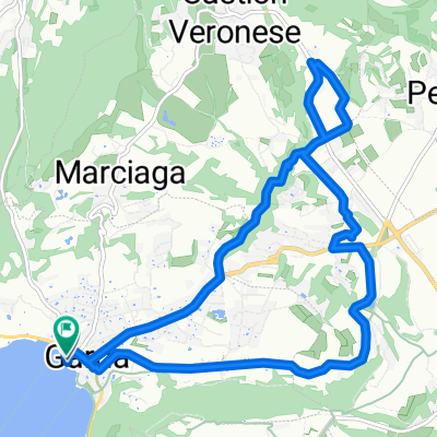
Durch das Tal der Mühlen
- 12.5 km
- 206 m
- 203 m
- Garda, Veneto, Italy
A cycling route starting in Garda, Veneto, Italy.
Overview
This route combines flat speed with great climbs and descents, as well as a rolling profile on the high plateau.
Impressive scenery and addictive curves!
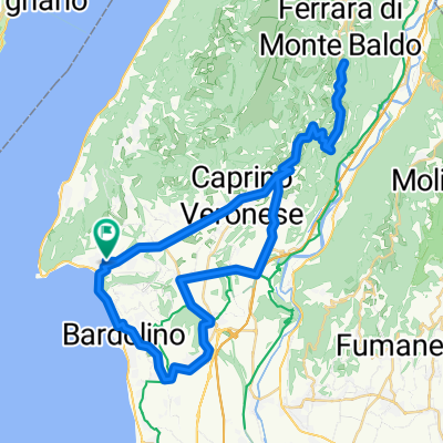
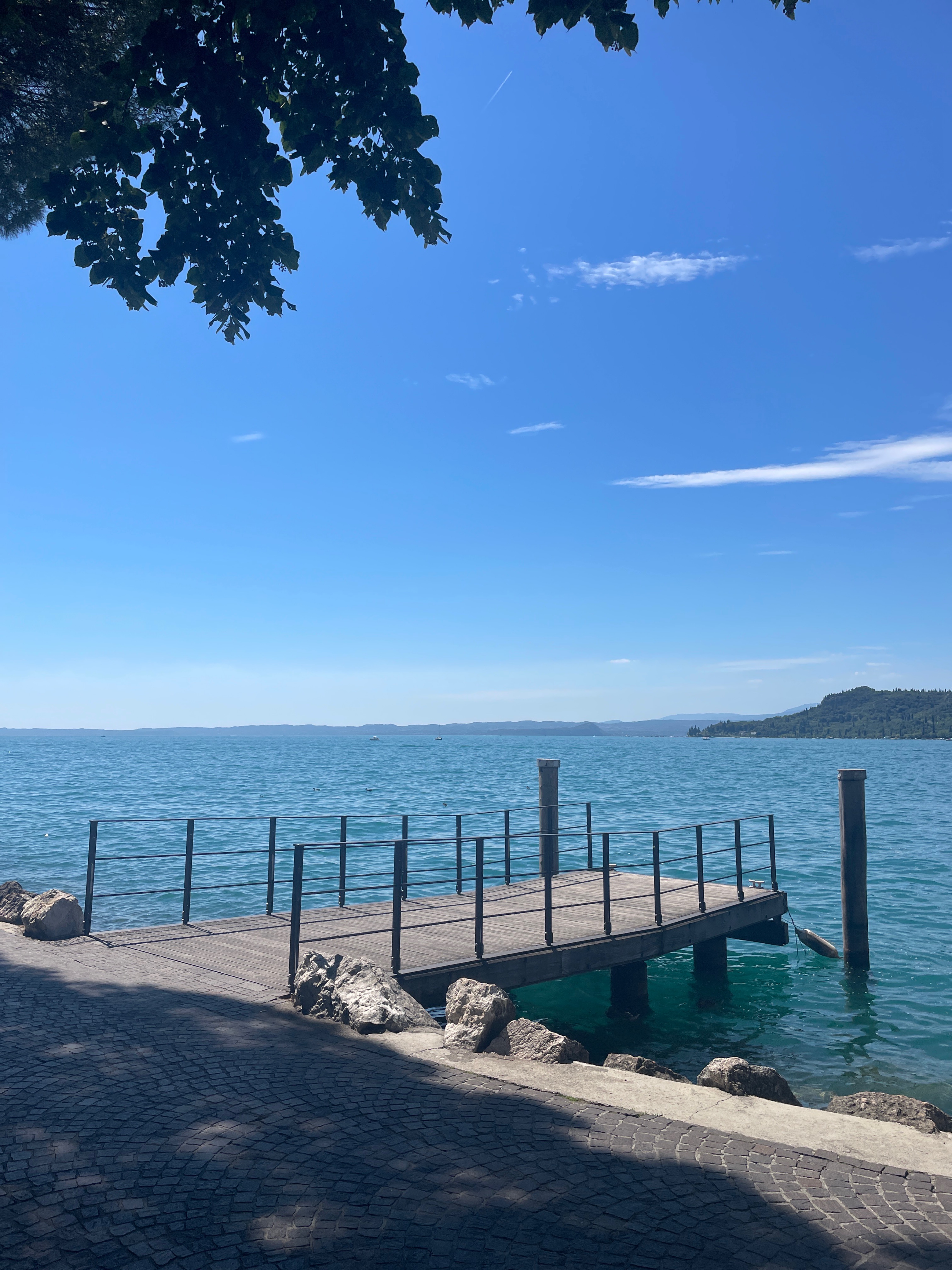
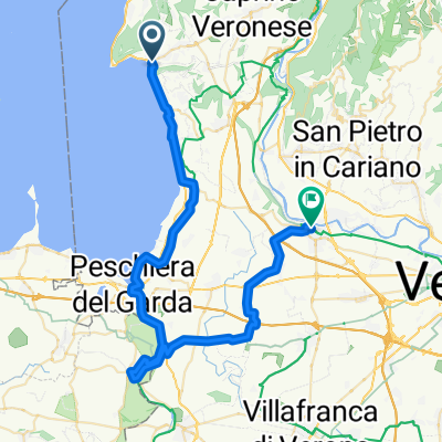
Starting in Garda, warming up along Lake Garda to Torri del Benaco. There, climb in wonderful switchbacks with stunning views of the lake, through the lovely town of Albisano and onward to Via Monte Baldo. A descent follows to Castion Veronese. Then, it’s flat and straight until Affi, where unfortunately you have to ride a few kilometers through heavier traffic. After crossing the river, a short stretch on a larger road, then turn left towards Sant'Ambrogio di Valpolicella. Passing the scenic town hall square, it’s uphill to San Giorgio di Valpolicella, and from there with beautiful views (remember to look back!) along the ridge towards the Monte. Just before the village, you turn off and ride uphill to Cavalo. After that, it flattens out a little in a constant up and down. You pass the Forte Masua and the mountain village of Breonio, and shortly after, it’s downhill to Fosse. But only then does it get really fast: over 700 meters of descent over less than two kilometers in a straight line, going down in breathtaking switchbacks (Caution: there may be occasional stones on the road!) down to Peri. For recovery, a relatively flat stretch follows (partly alongside the highway, which we did not find very disturbing) out of the valley to Zuane Osteria, where you turn left, then quickly right into Via Porton. From there, it goes straight on to Albarè Stazione, then a little uphill to then descend on wonderful switchbacks to Bardolino. From there, it's just a short stretch along the shoreline back to Garda. Anyone wanting to take it easy on this last short stretch can also leisurely (perhaps pushing) use the pedestrian promenade that runs directly along the lakeshore.
For me, this tour sums up all the highlights I know of the eastern Lake Garda! Beautiful! But surely there are more 'worth riding' routes there... I'll be back! :)
created this 13 years ago
Route quality
Road
23 km
(25 %)
Quiet road
14.7 km
(16 %)
Paved
83.7 km
(91 %)
Unpaved
1.8 km
(2 %)
Asphalt
83.7 km
(91 %)
Unpaved (undefined)
0.9 km
(1 %)
Continue with Bikemap
You would like to ride "Östliche Gardasee Rennrad Highlights" MONTAG or customize it for your own trip? Here is what you can do with this Bikemap route:
Free trial for 3 days, or one-time payment. More about Bikemap Premium.
Discover more Premium features.
Get Bikemap PremiumFrom our community
Open it in the app