Dookoła Polski 14 dzień ( Orzechów-Wolin)
- 169.5 km
- 241 m
- 310 m
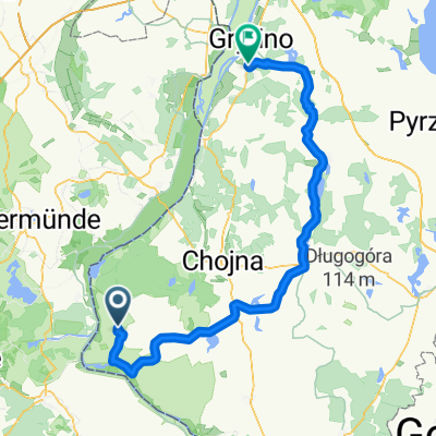
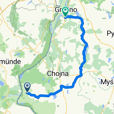
- Cedynia, West Pomeranian Voivodeship, Poland
A cycling route starting in Cedynia, West Pomeranian Voivodeship, Poland.
Overview
From Cedynia you can also find the way to the Oder dike (field path, then slab path on the dike) to Osinow Dolny. You can stop at Stare Lysogorki. In Czelin (about where the bend is, there is a monument) there is a nice elevated view over the Oder. From there, we had on a map a field path that promised a shortcut to the south, but it got lost in a cow pasture and then in the forest - so better to follow the Zielona Odra path towards Klosow ;-). From Klosow you have to find the right forest path (well passable, later asphalted, but 10 KM of little exciting straight through the forest) to Namyslin, this was only possible by asking. The section from Osinow Dolny to Gozdowice (ferry) would also be suitable for racing bikes. Ridden in April 2012.
created this 13 years ago
Route quality
Road
17.1 km
(28 %)
Track
10.4 km
(17 %)
Paved
41.6 km
(68 %)
Unpaved
11 km
(18 %)
Asphalt
41 km
(67 %)
Gravel
5.5 km
(9 %)
Continue with Bikemap
You would like to ride Cedynia - Kostrzyn or customize it for your own trip? Here is what you can do with this Bikemap route:
Free trial for 3 days, or one-time payment. More about Bikemap Premium.
Discover more Premium features.
Get Bikemap PremiumFrom our community
Open it in the app