
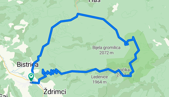
Green route
A cycling route starting in Gornji Vakuf, Federation of Bosnia and Herzegovina, Bosnia and Herzegovina.
Overview
About this route
- -:--
- Duration
- 56.6 km
- Distance
- 2,681 m
- Ascent
- 2,679 m
- Descent
- ---
- Avg. speed
- 1,952 m
- Max. altitude

Route quality
Waytypes & surfaces along the route
Waytypes
Track
20.8 km
(37 %)
Busy road
15 km
(26 %)
Surfaces
Paved
15.8 km
(28 %)
Unpaved
34.6 km
(61 %)
Gravel
34.6 km
(61 %)
Asphalt
15.8 km
(28 %)
Continue with Bikemap
Use, edit, or download this cycling route
You would like to ride Green route or customize it for your own trip? Here is what you can do with this Bikemap route:
Free features
- Save this route as favorite or in collections
- Copy & plan your own version of this route
- Sync your route with Garmin or Wahoo
Premium features
Free trial for 3 days, or one-time payment. More about Bikemap Premium.
- Navigate this route on iOS & Android
- Export a GPX / KML file of this route
- Create your custom printout (try it for free)
- Download this route for offline navigation
Discover more Premium features.
Get Bikemap PremiumFrom our community
Other popular routes starting in Gornji Vakuf
 Vranica: Radovina - Sarajevska vrata - Smrdivode
- Distance
- 43.8 km
- Ascent
- 1,487 m
- Descent
- 1,484 m
- Location
- Gornji Vakuf, Federation of Bosnia and Herzegovina, Bosnia and Herzegovina
 Bosna 3D T1
- Distance
- 68.6 km
- Ascent
- 1,858 m
- Descent
- 1,809 m
- Location
- Gornji Vakuf, Federation of Bosnia and Herzegovina, Bosnia and Herzegovina
 Uskoplje - Vranica - Prokoško - Rama - Uskoplje
- Distance
- 76.2 km
- Ascent
- 2,261 m
- Descent
- 2,261 m
- Location
- Gornji Vakuf, Federation of Bosnia and Herzegovina, Bosnia and Herzegovina
 Mačkovac -> Draševo -> Ramsko -> Blidinje
- Distance
- 85 km
- Ascent
- 1,999 m
- Descent
- 1,971 m
- Location
- Gornji Vakuf, Federation of Bosnia and Herzegovina, Bosnia and Herzegovina
 Vranica: Sikirski slap - Izvor Vrbasa - Prokoško jezero
- Distance
- 81.9 km
- Ascent
- 2,258 m
- Descent
- 2,253 m
- Location
- Gornji Vakuf, Federation of Bosnia and Herzegovina, Bosnia and Herzegovina
 Tura 1
- Distance
- 12 km
- Ascent
- 88 m
- Descent
- 88 m
- Location
- Gornji Vakuf, Federation of Bosnia and Herzegovina, Bosnia and Herzegovina
 Prokoško j.
- Distance
- 55.1 km
- Ascent
- 1,527 m
- Descent
- 1,527 m
- Location
- Gornji Vakuf, Federation of Bosnia and Herzegovina, Bosnia and Herzegovina
 Green route
- Distance
- 56.6 km
- Ascent
- 2,681 m
- Descent
- 2,679 m
- Location
- Gornji Vakuf, Federation of Bosnia and Herzegovina, Bosnia and Herzegovina
Open it in the app