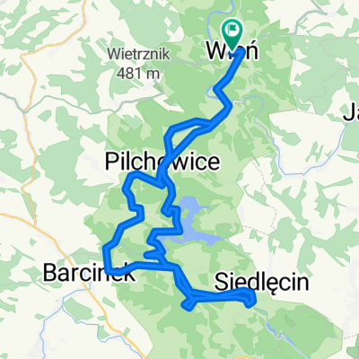
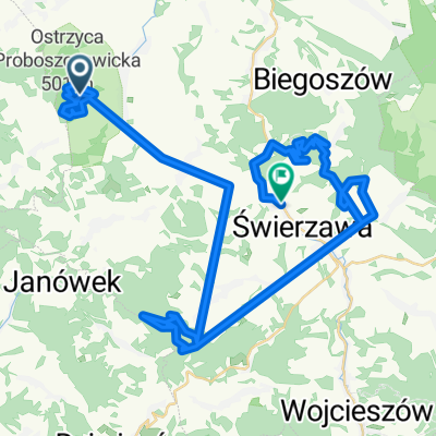
Riesengebirgsvorland
A cycling route starting in Wle艅, Lower Silesian Voivodeship, Poland.
Overview
About this route
entweder hoch oder runter, kaum befahrene Stra脽en,
- -:--
- Duration
- 99.3 km
- Distance
- 1,062 m
- Ascent
- 1,078 m
- Descent
- ---
- Avg. speed
- 420 m
- Avg. speed
Route quality
Waytypes & surfaces along the route
Waytypes
Road
47.4 km
(48 %)
Busy road
28.5 km
(29 %)
Surfaces
Paved
67.6 km
(68 %)
Unpaved
5.7 km
(6 %)
Asphalt
64.6 km
(65 %)
Ground
4.9 km
(5 %)
Route highlights
Points of interest along the route
Point of interest after 49.7 km
Sandsteinfelsen dir. am Ortsrand,
Continue with Bikemap
Use, edit, or download this cycling route
You would like to ride Riesengebirgsvorland or customize it for your own trip? Here is what you can do with this Bikemap route:
Free features
- Save this route as favorite or in collections
- Copy & plan your own version of this route
- Sync your route with Garmin or Wahoo
Premium features
Free trial for 3 days, or one-time payment. More about Bikemap Premium.
- Navigate this route on iOS & Android
- Export a GPX / KML file of this route
- Create your custom printout (try it for free)
- Download this route for offline navigation
Discover more Premium features.
Get Bikemap PremiumFrom our community
Other popular routes starting in Wle艅
- Pilchowie - Jelenia - Pilchowice wzd艂u偶 Bobru
- Distance
- 28.5 km
- Ascent
- 341 m
- Descent
- 341 m
- Location
- Wle艅, Lower Silesian Voivodeship, Poland
- Wle艅 - Ostrzyca - Zamkowa G贸ra
- Distance
- 44 km
- Ascent
- 721 m
- Descent
- 721 m
- Location
- Wle艅, Lower Silesian Voivodeship, Poland
- WR2017 dzie艅 2: Wle艅 - Lubawka
- Distance
- 94.4 km
- Ascent
- 1,298 m
- Descent
- 1,029 m
- Location
- Wle艅, Lower Silesian Voivodeship, Poland
- Maciejowiec_4
- Distance
- 75.5 km
- Ascent
- 903 m
- Descent
- 903 m
- Location
- Wle艅, Lower Silesian Voivodeship, Poland
- Wle艅
- Distance
- 18.3 km
- Ascent
- 319 m
- Descent
- 319 m
- Location
- Wle艅, Lower Silesian Voivodeship, Poland
- Dzie艅 4 Wle艅-Nawoj贸w 艁u偶ycki
- Distance
- 60.7 km
- Ascent
- 472 m
- Descent
- 506 m
- Location
- Wle艅, Lower Silesian Voivodeship, Poland
- Dolina Bobru
- Distance
- 23.5 km
- Ascent
- 685 m
- Descent
- 571 m
- Location
- Wle艅, Lower Silesian Voivodeship, Poland
- Zamek - kingsize - tunel - camping
- Distance
- 6.9 km
- Ascent
- 201 m
- Descent
- 306 m
- Location
- Wle艅, Lower Silesian Voivodeship, Poland
Open it in the app