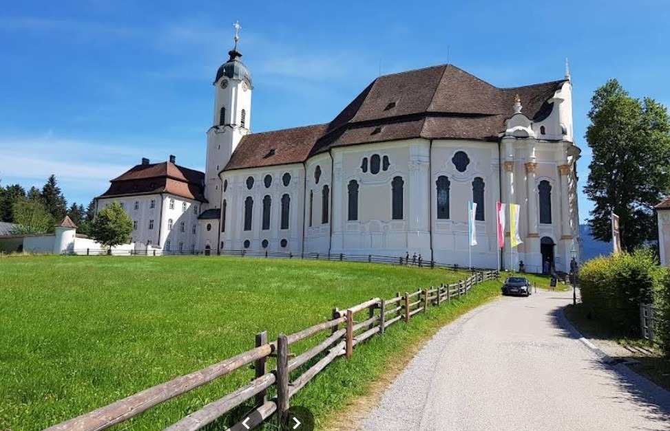
große Rundfahrt um das Estergebirge
A cycling route starting in Ohlstadt, Bavaria, Germany.
Overview
About this route
Eigene Messung mit VDO MC 1.0+
Ausgangspunkt am 04.04.12: Ohlstadt <table style="height: 221px;" border="0" cellspacing="0" cellpadding="0" width="87"> <tbody> <tr style="height:12.75pt" height="17"> <td class="xl22" style="height:12.75pt;width:123pt" width="164" height="17"> <table style="height: 198px;" border="0" cellspacing="0" cellpadding="0" width="206"> <tbody> <tr style="height: 12.75pt;" height="17"> <td class="xl24" style="height: 12.75pt; width: 132pt;" width="176" height="17">Gesamtstrecke Km</td> <td class="xl25" style="border-left: medium none; width: 60pt;" width="80">87</td> </tr> <tr style="height: 12.75pt;" height="17"> <td class="xl24" style="height: 12.75pt; border-top: medium none;" height="17">reine Fahrzeit in h</td> <td class="xl25" style="border-top: medium none; border-left: medium none;">4,12</td> </tr> <tr style="height: 12.75pt;" height="17"> <td class="xl24" style="height: 12.75pt; border-top: medium none;" height="17">durchschn. Geschw.km/h</td> <td class="xl26" style="border-top: medium none; border-left: medium none;" align="right">20,70</td> </tr> <tr style="height: 12.75pt;" height="17"> <td class="xl24" style="height: 12.75pt; border-top: medium none;" height="17">Max. Geschw. Km/h</td> <td class="xl25" style="border-top: medium none; border-left: medium none;">52</td> </tr> <tr style="height: 12.75pt;" height="17"> <td class="xl24" style="height: 12.75pt; border-top: medium none;" height="17">Höhenmeter gesamt</td> <td class="xl25" style="border-top: medium none; border-left: medium none;">664</td> </tr> <tr style="height: 12.75pt;" height="17"> <td class="xl24" style="height: 12.75pt; border-top: medium none;" height="17">Max. Höhe (Klais)<span> </span></td> <td class="xl25" style="border-top: medium none; border-left: medium none;">941</td> </tr> <tr style="height: 12.75pt;" height="17"> <td class="xl24" style="height: 12.75pt; border-top: medium none;" height="17">Durchschn. Steigung %</td> <td class="xl25" style="border-top: medium none; border-left: medium none;">3</td> </tr> <tr style="height: 12.75pt;" height="17"> <td class="xl24" style="height: 12.75pt; border-top: medium none;" height="17">Max. Steigung % (gstaig nach Kaltenbrunn)<br /></td> <td class="xl25" style="border-top: medium none; border-left: medium none;">12</td> </tr> <tr style="height: 12.75pt;" height="17"> <td class="xl24" style="height: 12.75pt; border-top: medium none;" height="17">Wetter</td> <td class="xl25" style="border-top: medium none; border-left: medium none;">sonnig</td> </tr> <tr style="height: 12.75pt;" height="17"> <td class="xl24" style="height: 12.75pt; border-top: medium none;" height="17">Temperatur</td> <td class="xl25" style="border-top: medium none; border-left: medium none;">15 -22</td> </tr> <tr style="height: 12.75pt;" height="17"> <td class="xl24" style="height: 12.75pt; border-top: medium none;" height="17">Abfahrt</td> <td class="xl27" style="border-top: medium none; border-left: medium none;">11:30</td> </tr> <tr style="height: 12.75pt;" height="17"> <td class="xl24" style="height: 12.75pt; border-top: medium none;" height="17">Ankunft</td> <td class="xl27" style="border-top: medium none; border-left: medium none;">17:30</td> </tr> <tr style="height: 12.75pt;" height="17"> <td class="xl24" style="height: 12.75pt; border-top: medium none;" height="17">Gesamtdauer mit Pausen</td> <td class="xl25" style="border-top: medium none; border-left: medium none;">6 h<br /></td> </tr> </tbody> </table> </td> </tr> <tr style="height:12.75pt" height="17"> <td class="xl22" style="height:12.75pt;border-top:none" height="17">Überwiegend Fahrradwege, selten stark befahrene Straßen. <br /></td> </tr> <tr style="height:12.75pt" height="17"> <td class="xl22" style="height:12.75pt;border-top:none" height="17">Ausgangspunkt beliebig, es empfiehlt sich in der Nähe der Autobahn A95. Parkplätze zB an der Ausfahrt Großweil vorhanden<br /></td> </tr> <tr style="height:12.75pt" height="17"> <td class="xl22" style="height:12.75pt;border-top:none" height="17">Charakter: weite, aber nicht allzuanstrengende Tour<br /></td> </tr> <tr style="height:12.75pt" height="17"> <td class="xl22" style="height:12.75pt;border-top:none" height="17">Tolle Gebirgsblicke Wetterstein und Karwendel<br /></td> </tr> <tr style="height:12.75pt" height="17"> <td class="xl22" style="height:12.75pt;border-top:none" height="17"><br /></td> </tr> <tr style="height:12.75pt" height="17"> <td class="xl22" style="height:12.75pt;border-top:none" height="17"><br /></td> </tr> <tr style="height:12.75pt" height="17"> <td class="xl22" style="height:12.75pt;border-top:none" height="17"><br /></td> </tr> <tr style="height:12.75pt" height="17"> <td class="xl22" style="height:12.75pt;border-top:none" height="17"><br /></td> </tr> <tr style="height:12.75pt" height="17"> <td class="xl22" style="height:12.75pt;border-top:none" height="17"><br /></td> </tr> <tr style="height:12.75pt" height="17"> <td class="xl22" style="height:12.75pt;border-top:none" height="17"><br /></td> </tr> <tr style="height:12.75pt" height="17"> <td class="xl22" style="height:12.75pt;border-top:none" height="17"><br /></td> </tr> <tr style="height:12.75pt" height="17"> <td class="xl22" style="height:12.75pt;border-top:none" height="17"><br /></td> </tr> </tbody> </table>
- -:--
- Duration
- 80 km
- Distance
- 517 m
- Ascent
- 517 m
- Descent
- ---
- Avg. speed
- ---
- Max. altitude
Route quality
Waytypes & surfaces along the route
Waytypes
Busy road
27.5 km
(34 %)
Track
23 km
(29 %)
Surfaces
Paved
64 km
(80 %)
Unpaved
11.8 km
(15 %)
Asphalt
62.6 km
(78 %)
Gravel
8.8 km
(11 %)
Route highlights
Points of interest along the route
Point of interest after 3.8 km
Gute Einkehrmöglichkeiten: Gasthaus zur Brücke und "ein Grieche" mit Super Biergarten
Point of interest after 53.5 km
Gute Einkehrmöglichkeit: toller Blick über den Walchensee ins Karwendel, super selbstgemachten Kuchen, Mittwoch Ruhetag
Point of interest after 74.8 km
Schwaiganger: Einkehrmöglichkeit mit Biergarten
Continue with Bikemap
Use, edit, or download this cycling route
You would like to ride große Rundfahrt um das Estergebirge or customize it for your own trip? Here is what you can do with this Bikemap route:
Free features
- Save this route as favorite or in collections
- Copy & plan your own version of this route
- Sync your route with Garmin or Wahoo
Premium features
Free trial for 3 days, or one-time payment. More about Bikemap Premium.
- Navigate this route on iOS & Android
- Export a GPX / KML file of this route
- Create your custom printout (try it for free)
- Download this route for offline navigation
Discover more Premium features.
Get Bikemap PremiumFrom our community
Other popular routes starting in Ohlstadt
 From Ohlstadt to Fussen
- Distance
- 68.8 km
- Ascent
- 1,004 m
- Descent
- 881 m
- Location
- Ohlstadt, Bavaria, Germany
 Ohlstadt-Hohenkasten-Ohlstadt
- Distance
- 59.5 km
- Ascent
- 412 m
- Descent
- 409 m
- Location
- Ohlstadt, Bavaria, Germany
 Genusstour Ohlstadt - Kloster Benediktbeuren
- Distance
- 45.1 km
- Ascent
- 229 m
- Descent
- 229 m
- Location
- Ohlstadt, Bavaria, Germany
 Von Ohlstadt übers Katzental nach Partenkirchen
- Distance
- 42.7 km
- Ascent
- 358 m
- Descent
- 358 m
- Location
- Ohlstadt, Bavaria, Germany
 MTB Walchensee/Ohlstadt
- Distance
- 50.2 km
- Ascent
- 893 m
- Descent
- 896 m
- Location
- Ohlstadt, Bavaria, Germany
 Durchs Murnauer Moos
- Distance
- 29.8 km
- Ascent
- 181 m
- Descent
- 201 m
- Location
- Ohlstadt, Bavaria, Germany
 Murnauer Moosrunde
- Distance
- 30.7 km
- Ascent
- 132 m
- Descent
- 132 m
- Location
- Ohlstadt, Bavaria, Germany
 Von Ohlstadt nach Burgrain
- Distance
- 41.2 km
- Ascent
- 257 m
- Descent
- 257 m
- Location
- Ohlstadt, Bavaria, Germany
Open it in the app

